After our recent MapSAR Training event at SARScene Canada 2013, Rick Laing of Ridge Meadows SAR, Elaine Girrior of Yellowknife SAR, and Peter Devanney of SAR Global 1 agreed to put together a shortlist of resources to start discussion and establish SARGIS collaboration across Canada. Here is what we have put together (this information may be useful even if your response area is outside of Canada).
Basemaps
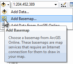
With regards to basemaps there are many resources available to you already while connected to the internet. For instance, below is a map of all of the Community Maps Program participants who adding even more detail to the World Topographic basemaps. Also within ArcGIS Online and ArcGIS Desktop you have access to the basemap produced by the Open Street Map program.
View Larger Map
To open these in ArcMap simply use the add basemaps function...
Here is a snapshot of some highly detailed data for Coquitlam

Base Data
There is a whole section about how to organize your Minimum Essential Data in the Using GIS for Wildland Search and Rescue textbook (free download) and also in an earlier blog post "Pre-planning is half the battle". Base data can be tricky for new GIS users because these datasets tend be rather scattered across the internet and are hard to track down if you do not already work with a GIS Specialist. But we thought we would point out some Canada-specific data sources for all of you here.
- Search ArcGIS Online
- GeoGratis Prepackaged data sets (geodatabase by data type / Province)
- GeoGratis Geospatial Data Extraction tool
- GeoGratis CanVec Vector Data
- GeoGratis Toporama Topographic Maps
- Centre for Topographic Information vector data ftp site
- Centre for Topographic Information elevation data ftp site
- GeoBase Web Mapping Service (adding WMS to ArcGIS Desktop)
- MapTown Topographic Maps (not free)
- Quebec 1:20,000 Topo (not free)
In many cases this will require you to download the data in various formats, unzip the data, add it to your map, and style it appropriately.
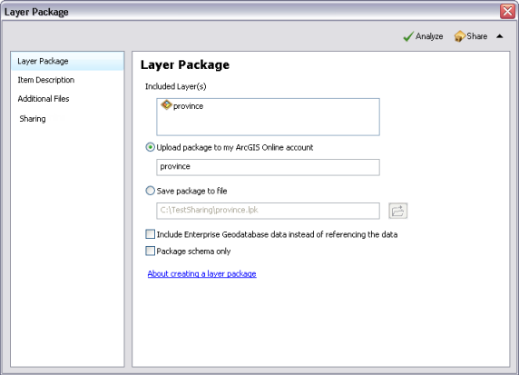
Creating a layer package clipped for your specific area is a great way to keep these data portable and organized. When you unpack them they keep your geography and symbology and can be stored locally, on a portable drive, and ArcGIS Online.
ArcGIS Desktop for Nonprofit Organization Program by Esri Canada. Go to the website and Request Application for Membership
- $100 for ArcGIS Desktop (administrative fee)
- Designed for small ground SAR organizations in Canada
- Organization can not be a Nationwide and/or Government owned agency
- Community Based Non Profit Volunteer Organization (with or without a CRA#)
- Must be associated with SARVAC, CASARA, or Northwest Territories
- CRA Charity registration number - not needed, simply note your relationship with SARVAC
Download MapSAR template for ArcGIS Desktop from www.mapsar.net
MapSAR is a free tool that runs with ArcGIS 10, 10.1, and 10.2 to store geospatial information, enabling SAR maps to be generated, stored, and printed quickly so that search teams can get out the door faster to look for the missing person.
Join our Discussion Group!
A group for National Park Rangers, Sheriffs, Mountain Rescue Associations and other emergency service people to discuss and help others use and implement GIS (Geographic Information Systems) technology in SAR (Search and Rescue), emergency and day to day operations. Central to our group’s goals is to make GIS techniques and technologies more accessible to non-specialists. Towards this end, we have continued to explore techniques and technologies that can create a more streamlined workflow and effective situational awareness when using GIS.
What's next?
From here we hope the real discussions can begin.- Should there be a Canada SARGIS User Group?
- Where will the next MapSAR Training be?
- How can base data and even pre-planned operational data be stored and shared for teams to utilize (see example)?
- How do I meet local GIS Specialists and work with agencies already using GIS in my area?
In the meantime, please do visit the NAPSG MapSAR and IGT4SAR for online training videos and stay informed via the SARGIS Discussion Group. Don just uploaded a video that highlights the importance of minimum essential datasets and breaks down some GIS basics here in this video: http://www.youtube.com/watch?v=qdOM9RsQ1ZI
Let's continue the discussion and collaborate around this topic.


