Friday, February 1, 2013

NAPSG Wildland MapSAR Training in Bellevue, Washington

NAPSG Wildland MapSAR Training in Bellevue, Washington
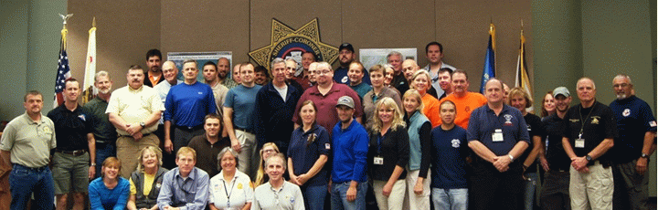
Registration is now open to participate in a free training session.
Saturday April 6, 2013 -to- Sunday April 7, 2013 

Participants will learn how to use the free MapSAR tool with Esri’s ArcGIS Desktop product. The product and training session are designed for individuals with limited or no GIS experience.
GIS has proven to be beneficial when mapping emergency incidents. This class will teach you how to create search segments (probability areas), draw search assignments and print maps for field crews and the incident command post. You will also learn how to track incident activities like clues, field team status, debriefing information and GPS track logs.
This is a hands-on training class: computers, textbooks, reference manuals and software will be provided for up to 50 students.
NAPSG and Esri will be sponsoring the event.
NAPSG is the National Alliance for Public Safety GIS. This is their mission, "To support the public safety and homeland security communities in the advancement of data interoperability and information sharing, through geospatial technology, in support of local and national emergency preparedness".

Thursday, January 24, 2013

UTM / USNG Locator Map

I corrected the links and made some updates to the map!

UTM / USNG Locator Map

So what if you just want to know what UTM / US National Grid Zone you are currently in or will be deploying to? Here is a simple and easy to use tool for you. Click on the image or here.

ImageThis web mapping application was created using an ArcGIS Online Web Map and a hosted Web Mapping Application template.

Monday, January 7, 2013

GISCorps volunteers assist in a Search & Rescue pilot project in California

GISCorps volunteers assist in a Search & Rescue pilot project in California.

Check out the link. This is excellent news from the GISCorps!

What is happening?

In late 2012, GISCorps received a request for volunteers from a consortium of GIS and Search and Rescue (SAR) professionals from Sierra Madre Search and Rescue Team, Esri, Sequoia and Kings Canyon National Park, Yosemite National Park, Grand Canyon National Park, and Mountaineer Rescue Group who have developed a Search and Rescue application called MapSAR. The consortium requested assistance to fill three GIS Specialist positions to support a pilot project in California using MapSAR. Those three positions were: GIS Trainers, GIS Practitioners and GIS Developers. The detailed job description for each position and other additional information is included in this document.

Who is GISCorps? From their website:

GISCorps started life in October 2003 in Atlanta, Georgia, when the URISA Board unanimously approved it as an initiative of URISA. This happened after an intensive summer of brainstorming, conceptualizing and a lot of hard work required to translate an idea into a well designed proposal. GISCorps is now a URISA program and operates entirely on a volunteer basis. The core committee members, most of whom are themselves GISCorps volunteers, run the program with administrative help from the staff at URISA. They reside in different states accross the United States and Canada and use a wiki site to work collaboratively, mostly at nights and on weekends. The links that follow describe in detail the mission and the operations of the GISCorps.

GISCorps volunteers' services will help to improve the quality of life by:

  • Supporting humanitarian relief.

  • Enhancing environmental analysis.

  • Encouraging/fostering economic development.

  • Supporting community planning and development.

  • Strengthening local capacity by adopting and using information technology.

  • Supporting health and education related activities.


GISCorps has accepted the challenge and the California Emergency Management Agency SAR Operations and the National Park Service are anticipating the integration of GIS Specialists into their ranks for supporting Search Operations with GIS. This is a great opportunity to bring in GIS professionals and their expertise to support an inherently spatial problem: searching for missing persons. Once we have learned from this experience it can be taken to a national / international level.

MapSAR San Bern

Saturday, December 29, 2012

"What is a Field Map?"

So you are on an active Search Operation and someone asks for an assignment map. What do you do? Well hopefully you have already read and digested the Using GIS in Wildland Search and Rescue text and are using the MapSAR templates. Here, Don Ferguson and I dig a little deeper into the topic of what to put on an assignment map.

Image

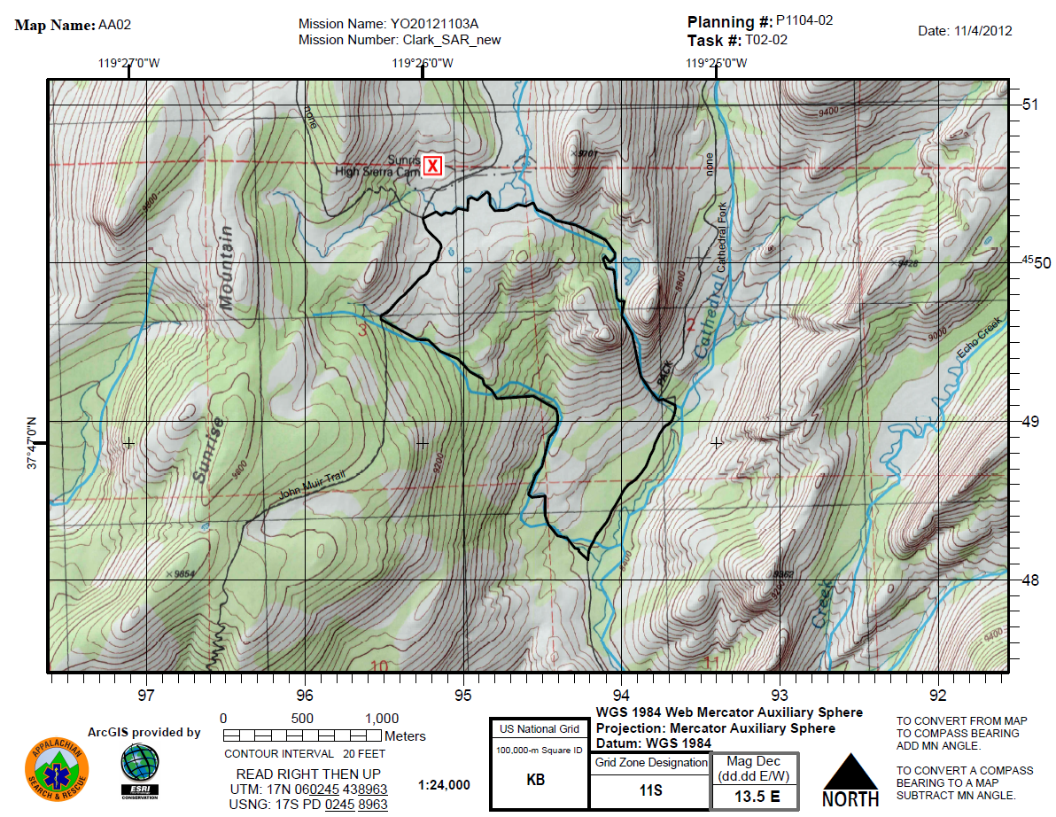
The Task Assignment, or Field Map is an essential element for search teams going into the field in response to search and rescue operations.  These maps provide assistance with team navigation as well as the ability to communicate certain attributes about specific location (e.g. the position of a clue).

Although these maps play a critical role in team safety and search effectiveness, there doesn't appear to be a documented effort at standardizing the basic layout and the information contained in the map. ASTM standards F 1846 and F 2099 have provided guidelines for map symbology and the use of UTM grids, respectively, but these standards stop short of suggested critical information that should be presented on the map itself. In addition, with the adoption of US National Grid as a standard for all Public Safety agencies in the United States you will need to make some modifications to your old UTM/lat long habits soon. For a dynamic USNG overlay you can use web services found on ArcGIS Online or check out the ArcGIS Desktop Help documentation: Adding an MGRS and U.S. National Grid.

What about basemaps? What should we use? The USGS 1:24,000 topographical map has long been the de facto standard map used by wilderness SAR teams in the United States as these maps have provided basic information on geographic features to assist with navigation. These can also be found on ArcGIS Online or downloaded from most State GIS Portals for free. Given the familiarity of SAR personnel with the format of the USGS topo map, teams often settle on a layout similar to that of the USGS maps with information limited to this basemap.  While this may have been adequate for keeping teams safe in the field it may not provide sufficient information for emergency response and effective search operation. In addition, most of the maps are now out of date or will not feature recent hazards.

In today's world of digital mapping we now have the ability to not only create our own map templates for populating broader information but we can also create our own maps combining up-to-date geospatial information with various types of basemaps (imagery, topography, streetmaps, etc).  This not only supports a greater situational awareness for the teams in the field but also critical connectivity between field operations and overall search management.

Finally, what else do we need to have on an assignment map? Although during a search operation maps may be created for a variety of needs, we focus here on field maps that accompany task assignments.  These maps must clearly communicate the task assignment as well as provide detailed information regarding travel routes and navigational aides, hazards and position.  In building a basic field map, we can consider both required elements and optional elements:

Basemap: Topographic map, Imagery with other data, Streetmap, etc.  Keep in mind how the map will look when printed in black and white just in case you need to make photocopies. Remember, imagery alone IS NOT A MAP.

Grid: Lat-Long, UTM, US National Grid or some combination.

Map Elements (S.T.A.N.D.D.): 

  • Scale: Responders need to be able to relate distances and size on the map to the real world. If the map is “not to scale” then write that on the map. Be careful as map scale may change with copying process.

  • Title: The title should actually include various information including: Incident name, Incident Number, Map Name and Task Assignment Number.  Assignment number also provides a link to the Operational Period for the assignment.

  • Author: The person and agency that created the map.

  • North Arrow: This should always be on the map.  Since the maps may also be used for navigation by compass you should also include reference to Magnetic Declination.

  • Date: The date and time information gathered should be written somewhere on the map.

  • Datum: The datum of the coordinates on the map This is important information for relaying coordinates and for GPS use.


Command points / ICS Features: Initial Planning Point, ICP, Radio Relays, etc

Legend: Especially, if non-standard symbols are used.

Task Assignment: This should be clearly indicated on the map.

You can also take a look at the GIS Standard Operation Procedures for more insight. We'd love to see some examples of your assignment maps and share what others are doing with the SARGIS community. So send us your maps and let us know if you have any questions.


Sunday, December 9, 2012

Pre-planning is Half the Battle

Here at the MapSAR Training in San Bernardino there have been a lot of meaningful sidebar conversations. Speaking with a member of Ventura County SAR, I felt like it was time to open a broader discussion on Search Operation pre-planning. We want to know, what types of geographic features you are using on operations?

Here is a list we discussed:
  • Roads
  • Trails
  • Trailheads
  • Streams
  • Powerlines
These are just some of the datasets that should be included in your Minimal Essential Dataset (MED) and could be used for planning search segments in advance of an incident.

Image

However, over the past year our Using GIS in WiSAR group have been tinkering with the use of Watershed Boundaries for the use of planning areas or even starting points for segment delineation. 

*UPDATE* March 3rd 2017

Why watersheds?  "It is evident that the topography affects how people move through their environment, so instead of looking at how far they travel in a straight line from where they were last seen in order to predict where to look for them, perhaps it would be better to analyze the topographic features around them. One way in which to do this is by analyzing their movement between watersheds." - Read more in Jared Doke's MS Thesis.

This has been further supported in research by Elena Salva in a research article titled: Evaluating Lost Person Behavior Models. 

Now that the latest National Hydrological Dataset has been released, it would be a good idea to download the dataset and add it to your MED.

Image

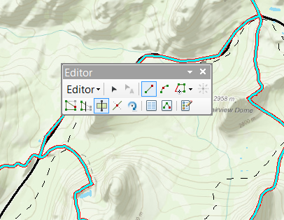
Then you can use some of the editing tools, such as cut polygons to begin breaking down the watershed boundaries into searchable segments by other features such as roads and trails.

EditorCutPoly

This is a big breakthrough for Using GIS in WiSAR and researchers Jared Doke, Robert Koester, Don Ferguson, and Charles Twardy are testing these watershed boundaries against/with Lost Person Behavior models for determining Probability of Area. In addition Lori Peltz-Lewis will be working with GISCorps to make sure SAR Teams in California have this and other datasets for their MED.


I hope this post sparks discussion on pre-planning and discuss what others are doing or will do to prepare for their next search.

For those of you "North of the Border"....Here is a watershed data source that was forwarded to me today for Canada. I have not taken a look yet, but feel free to check out the
link.

http://geobase.ca/geobase/en/data/nhn/description.html

NHN dataset (Nation Hydro Network) that NRCAN provides. It has 1:50k data (interpolated from coarser data where finer data is not available) standardized across Canada. In some regions, the provinces have partnered up to provide better quality data and rely less on the
general computer model to compute the data.

*UPDATE* March 3rd 2017

The USA Watersheds are also available in ArcGIS Online for use in web maps, apps, and ArcGIS Pro through the Living Atlas of the World program. You can test this in the web mapping app embedded below.

Thursday, December 6, 2012

"Clip Before You Go"


Today I spoke with Brian Quinn, a GIS Analyst for the County of Marin, California. We were discussing how he can support Marin County SAR as they begin implementing MapSAR and building out Minimum Essential Datasets. On the one hand most vector data can be collected ahead of time and stored as geodatabase and/or layer packages. But sometimes you need to quickly grab new data on the fly. Together, we thought of a really quick way the Marin SAR Team could use Free and Public ArcGIS image services to clip raster data (basemaps, elevation models, imagery) before leaving the office.


Here is what we tested in ArcGIS Desktop.

Image

  • Next Zoom into an Area of Interest and open the Image Analysis Window


ImageAnalysisWindow

  • Then use the Clip and Export buttons to grab the data you need


ClipAndSave

  • Finally, use your Using GIS for WiSAR textbook to figure out the best practice for adding this to your Minimum Essential Dataset (MED) within the MapSAR folder structure


SaveIt

These clipped rasters will now be available when you disconnect and can be added to your MapSAR document and printed on your maps. There will be size limitations but for most incident specific extents this should work. In the long term, you will need a more holistic approach to Data Management. See the Using GIS for WiSAR textbook.

For more information, see the Help on the Image Analysis Window. For another example of imagery deployed via free web services see the California Department of Fish and Game Map Services website.

This is just one of many ways you can collaborate with your local GIS Specialist. Most GIS Specialist are pretty friendly and eager to help because they likely found their profession in GIS by looking for meaningful work and making a difference. If you do SAR work, you likely have something in common. So - give them a call, buy them a beer, invite them to a SAR meeting, and send them to our SARGIS Discussion Group!