After a few years of teaching how to deploy MapSAR Online,
Alix Vezina and I decided it was time to open up the no-cost training to a much wider audience.
In this lesson, you'll create a web map to prepare data for search operations. Your map will contain static base data showing regional boundaries and key features, as well as editable layers that can be changed as an incident develops. Then, you'll use the map to create a web app that even non-GIS professionals can use. Finally, you'll use the app to track a fictional SAR mission.
We worked with the Learn ArcGIS team to produce a lesson that walks you through the following steps:
| Create a map | Create and configure a web map with base and incident data. | 30 minutes |
| Create an app | Create and configure a web app with tools to support search operations. | 1 hour 15 minutes |
| Map a search operation | Use the app to map a fictitious search and rescue operation as it happens. | 1 hour 15 minutes |
This will give a GIS professional a basic understanding of search and rescue OR a SAR professional a basic overview of how ArcGIS Online works. The app you create is using .
We plan to do follow up blog posts on topics:
- Integration with
- Integration with SARTopo
- Archiving Incidents
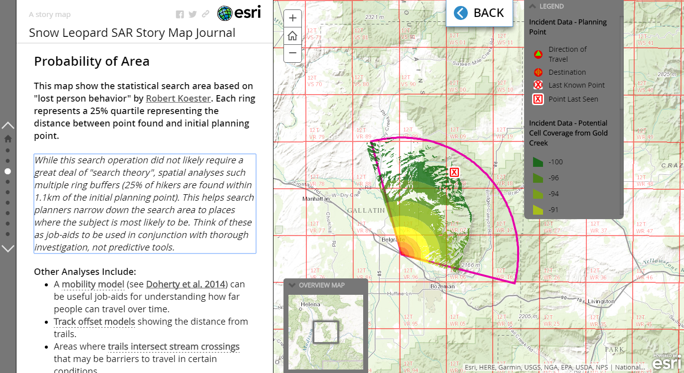
- Spatial Analysis
- +More