Showing posts with label 2014. Show all posts

Monday, December 15, 2014

2014 WiSAR GIS Year in Review: Map Tour

Click on the link: Map Tour


In the year 2014, great advances were made in the use of geographic information systems for wildland search rescue. 
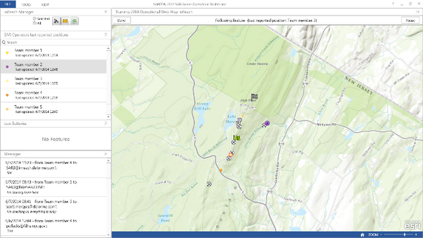
  • MapSAR and IGT4SAR were used to support a number of missing person search operations
  • Workshops were held across North America
  • There were several peer-review publications on the use of GIS in WiSAR
  • The US National Park Service has recognized the GIS Specialist role as a necessary incident command structure position during search operations
More important than the updates in technology, policy, or science, is the connection between the great people driving this movement. We have so much to celebrate - excellent work everyone and thank you for time and dedication to such a noble cause.

However, while much was accomplished this year, the reality is, GIS is still not widely used in missing person search operations and other SAR functions

What can we do in 2015 as a volunteer community to increase the adoption of GIS as a critical SAR function in North America and abroad? 

  • Develop simple to use geo-enabled applications for mission critical tasks? 
  • More SARGIS workshops? 
  • Form a recognized non-profit organization with operational capacity to help when needed? 
  • Present to emergency management and law enforcement agencies? 
  • Lobby to federal governments for more support?
  • Strengthen the alliance with GIS volunteers like GISCorps, MapAction, MAPS? 
  • Create a research and development center for WiSAR GIS? 
These are all ideas that have been discussed and are always on my mind. Now that the SARGIS Discussion Group has reached +600 members across the world I truly believe we have reached the critical mass to make global change. 

I think we can all agree, that someday, when a person goes missing, the use of GIS for planning, operations, logistics, command, and public information will be the "standard of care". Imagine that your loved one (a relative, a spouse, your child) was missing - how would you want the search management team to use geographic information?

Let's make 2015 a spectacular year and have a great time doing it - so that others may live... 


Please add comments below if you think we missed an event, have a case-study you think should be highlighted, or have ideas on how we can make a bigger impact. 


Monday, June 23, 2014

#SARGIS6 Discussion and Report

This blog post highlights the activities and topics covered in the 6th Annual Search and Rescue GIS Meeting. The meeting was held simultaneously in Dunsmuir, California and Morgantown, West Virginia. The final agenda can be found here: https://esri.box.com/SARGIS6Agenda


MapSAR Training - Thursday and Friday


We kicked off the week on Thursday morning at the Dunsmuir High School with the Yosemite ("Clark SAR") Tutorial. There were both GIS Professionals and SAR Professionals (most with little or no GIS experience) in the room. The students were able to complete the tutorial in one day and get through the basics of MapSAR. Excellent instruction was provided by Jared Doke, Caroline Rose, Rick Laing, and Dave Hansen from the GISCorps. On Friday we then started from scratch and launched MapSAR to respond to a fictional scenario on Mount Shasta, the "Hunter SAR". 

Friday Evening


After some free time to check out the town of Dunsmuir and an open house at FireWhat Headquarters we went to the theater for a keynote address on WiSAR GIS Research and an introduction to the FireWhat Team. This was followed by some live music, dessert, and a raffle on top of the Dunsmuir Hotel rooftop. 

Saturday

Beautiful Mount Shasta was a great backdrop for our meeting.


For the rest of the conference we spent time up at the Mount Shasta Ski Park after a great interpretive talk from Nick Meyers, Mount Shasta Ranger. On Saturday Morning we received a MapSAR update from Jon Pedder and were introduced to the Antris Registry by Kaila Beattie. Then we heard some excellent lightning talks:
  • Who are the GISCorps? Dave Hansen
  • Using GIS for Kansas USAR Jared Doke
  • Why don’t we all just use GIS? Caroline Rose 
  • Remote Support for WiSAR Don Ferguson
  • Using cell phone analysis for WiSAR George Durkee
In the afternoon - we used our "Hunter SAR" scenario to try out some new technology in conjunction with MapSAR. We published our incident data to an ArcGIS Online web map and launched the Collector for ArcGIS for mobile data collection. We also used DeLorme inReach devices for situational awareness in the field - we always knew the location of our teams. 


Finally - we tied all of this information together using the Operations Dashboard to track team status and instantly view photos of clues from the field. This is the first time we have tried this integration and it worked quite well. We still used the paper maps from MapSAR as a fail-safe method to make sure teams had the information they needed in the field. 

For free training on this new technology:
Finally, we finished off the meetings with presentations:
Both days of the meeting were shared via webcast with SARGIS East. Despite technical difficulties most of the presentations were recorded and available (I am working on converting these videos into a viewable format right now).


What did we learn? What's next?


  1. It is time to present what the SARGIS community has to offer to agencies that have jurisdiction, not just the volunteers
  2. We need to simplify deployment of MapSAR / IGT4SAR workflows for Day I of operations
  3. We need to move MapSAR / IGT4SAR to one code-sharing framework (GitHub)
  4. How do we implement remote support procedures?
  5. Should the WiSAR GIS group become a non-profit (5013c) organization?
  6. UAV/S have a role in WiSAR - but it is yet to be determined how they can be used effectively, we need to do more research


We are looking forward to SARGIS7 and potential locations have already been discussed (Simon Fraser University, University of Wisconsin - Madison, Estes Park, Dunsmuir, CA).

Look for updates from SARGIS East soon as well.

Please continue the discussion or ask followup questions from the presenters on the SARGIS Discussion Group.

Sunday, June 8, 2014

Search and Rescue GIS at #SARCON2014


The last stop of my Eastern US tour brought me to New Jersey for the MRA / NASAR 2014 Search and Rescue Conference. New Jersey Search and Rescue are pioneers in search operation mapping and communication - so this was the perfect place to talk about the importance of GIS in wildland search and rescue. The conference was very well run and a great time to connect with friends and learn more about what others are doing.

Don Ferguson gave an excellent talk about minimum essential data for situational awareness and spatial analysis during search operations. He also showed the power of spatial analysis, such as travel cost modeling for increasing your theoretical probability of area


Captain Pollackov from FDNY GIS provided a detailed account of how GIS was used for Hurricane Sandy and the Super Bowl, as well as a sneak preview of how FDNY will be using GIS in the future. Our friends at ICE-SAR were very impressed. 


Jon, Jennifer, Jason, Don, Cole and myself were extremely busy at the Esri booth providing mini training sessions to old friends, but also many MRA and NASAR Teams that have not begun implementing GIS into their operations. I also presented and discussed the MRA Mission data collection system using ArcGIS Online. Here is a link to the training videos if you have not seen them already. 


Finally, during the SAR Games activities on Friday, we teamed up with our friends at DeLorme to test the integration of InReach, Collector for ArcGIS, and the Operations Dashboard for real-time tracking and operational mapping. We showed this on live maps in both the Hilton command post and remote command post at High Point State Park. During this time I also hung out with the Alpha SAR Team and discussed the future of GIS in their operations.  


Overall, here is what I learned this year at SARCON2014:

1) The common theme across the Arkansas SAR, ASRC, MRA, and NASAR communities is the concept of remote support for search operations. 
2) Disconnected capabilities are a must - you must be able to support your operation with no internet access for at least 72 hours. However, there are creative ways to leverage support from outside the command post...
3) In general, little work has been done using GIS outside of search operations. I have not spoken with a single team that has incorporated GIS into preventative search and rescue (PSAR) or rescue response (optimal siting of resources, suitability analysis, etc). 

I look forward to giving a more detailed report at the SARGIS6 Meeting in a few weeks!


ps beware of the Alaskan Embassy and anything offered to you in another language.


Friday, May 23, 2014

Search and Rescue GIS 2014 Eastern US Tour


2014 has already been a great year for WiSARGIS. The community has rallied around some common workflows and is always discussing cutting edge technology on the SARGIS Discussion Group. In addition the Mountain Rescue Association is showing leadership in the Community by beginning their first implementation of a geo-enabled mission collection system (more on that soon!).  


On Monday, I leave for Forth Smith Arkansas where the University will be hosting a cadre of MapSAR Instructors. Wes Cleland, Mark Hollingshead, Caroline Rose, and Marcus Kitchens will be teaching MapSAR to a class of GIS Professionals who support agencies throughout the "Tri-State" area (Oklahoma, Arkansas, Missouri). This event is supported by the NAPSG Foundation and Esri. Also members of the GISCorps will be in attendance as well!

Then, on May 31st, the University of Virginia will be hosting the 40th Annual Meeting of the Appalachian Search and Rescue Conference and  Blue Ridge Mountain Group's 40th Anniversary event where I will present on the status and future of the SARGIS Community. This should be a great event in a region I have not spent nearly enough time in. 

After this, FDNY Fire Captain Steve Pollackov and I will present at The National Association For Search And Rescue and the Mountain Rescue Association National Conference (SARCON2014) in Woodcliff, New Jersey. I will be sitting the Command Post during the SAR Games as well, showing how GIS can be used for planning, operations, logistics, command and public information during an incident or training (more to follow!). I have not been back home in a while, it might be time for some real pizza.

This should be a great trip and I will be sure to highlight what I learn here on the blog. Then I will present on this at SARGIS6 in Dunsmuir, CA later in June. I hope to see some of you at these events so we can catch up. 


Special Thanks to Mamata Akella on the NPMap / ArcGIS Online integration!

Monday, April 28, 2014

2014 Tornado Maps and Apps

Since many of you in the Search and Rescue Community are involved in Tornado Response and Recovery, I thought I'd post some resources here. 

Esri Disaster Response Emergency Assistance Form - Request GIS software, data, and support 24/7.

Collector for ArcGIS for online / offline data collection

Access to Tornado Data from our Open Data site (Beta)

Severe Weather Public Information Map 

SARGIS6 East June 20th - 22nd


We are pleased to announce the schedule of events for the SARGIS6 East workshop to be held June 20 - 22 in Morgantown, West Virginia.  The workshop is being sponsored by the West Virginia Division of Homeland Security and Emergency Management which allows participants to attend at no cost.  The location is the West Virginia GIS Technology Center on the Campus of West Virginia University. 

Please email Don Ferguson to confirm attendance. 


View Larger Map


The workshop is being offered in conjunction with the SARGIS6 West Meeting and will follow a similar schedule.  
Similar to the SARGIS6 West Workshop, the purpose of the SARGIS6 East workshop is:
- Introduce how Search and Rescue (SAR) and other public safety operations can benefit from GIS.
- Introduce the IGT4SAR Map Template for ArcGIS (free download)
- Learn how GIS can help with planning and mapping within ICS operations.
- Gather volunteers to share and discuss SAR strategies.
- Highlight tactical SAR procedures/ data management.
- Demonstrate cutting-edge GIS mapping tools that can be utilized by SAR personnel.
- Help SAR organize and spatially categorize field data.
- Continue to build and strengthen the SARGIS Community!
Training
Everyone is invited to attend this course: GIS Specialists, SAR personnel, Emergency Managers, Emergency Responders, etc. For those of you with minimal experience using GIS please complete these two free online training modules prior to the class:

2. Basics of Geographic Coordinate Systems (for ArcGIS 10)
http://training.esri.com/gateway/index.cfm?fa=catalog.webCourseDetail&courseid=2117
Agenda
The draft schedule is listed below (subject to change as we coordinate with the west coast):
Friday (6/20)
0900h - Introductions
0930h - IGT4SAR Training Session I
1200h - Lunch (on your own)
1300h - IGT4SAR Training Session II
1600h - Presentation: Why use GIS for WiSAR (webcast with west coast)
1730h - Adjourn
Saturday (6/21)
0900h - Minimum Essential Dataset - Base data
1000h - Making Maps with IGT4SAR and ArcGIS
1100h - Lunch (on your own)
1200h - Introductions (webcast)
1230h - Presentation: 2013 SARGIS Review, 2014 What's coming next? (webcast)
1330h - Presentation / Discussion: How to use Cell Phone data for SAR (webcast)
1430h - Utilizing GPS for SAR
1530h - IGT4SAR Training Session III
1730h - Adjourn
Sunday (6/22)
0830h - Geospatial Analytic Methods applied to SAR
0930h - IGT4SAR Training Session IV
1100h - Lunch
1200h - Presentation: SARGIS Case Studies (webcast)
1245h - Break
1300h - Presentation: What's new in Lost Person Behavior?
1345h - Break
1400h - Discussion: What do we want to accomplish in 2014?
1430h - Discussion: Q&A with ESRI
1500h - Adjourn


Accommodations in Morgantown:
Staying in Morgantown is pretty inexpensive.  The government per diem rate is $83 /day for lodging.
Parking on Friday may be a bit tricky on Friday.  I recommend you park at the University Ave Garage which has 24 hour available parking.  If you stay at either the Hotel Morgan or Waterfront Place they have parking available so you would probably want to check in before coming to class.  Saturday and Sunday parking is free on campus and WVU lot #10 is right outside Brooks Hall.  Just turn in off of Campus Drive (see the map).

The closest hotel (walking distance) to the training venue is the historic Hotel Morgan:
http://www.clarionhotelmorgan.com/
The Waterfront Place is very nice:
http://www.waterfrontplacehotel.com/
Also nice and walking distance to the PRT (http://transportation.wvu.edu/prt):

1) Residence Inn by Marriott - http://www.marriott.com/hotels/travel/MGWRI-Residence-Inn-Morgantown
For those of you flying in for the course, the closest large commercial airport is the Pittsburgh International Airport:
http://www.pitairport.com/
The Pittsburgh airport has easy access to car rentals and the local Morgantown transit authority runs a twice a day shuttle to the airport:

http://www.busride.org/MapsSchedules/Routes/29GreyLine.aspx

Wednesday, April 23, 2014

Space-time analyses for forecasting future incident occurrence: a case study from Yosemite National Park using the presence and background learning algorithm


This follow up paper to the Yosemite Search and Rescue Incident Georeferencing Study has been published in the International Journal of Geographical Information Science. Many thanks to my colleagues and all of the volunteers who have helped support this project! 

Abstract

To address a spatiotemporal challenge such as incident prevention, we need information about the time and place where incidents have occurred in the past. Using geographic coordinates of previous incidents in coincidence with spatial layers corresponding to environmental variables, we can produce probability maps in geographic and temporal space. Here, we evaluate spatial statistic and machine learning approaches to answer an important space-time question: where and when are wildland search and rescue (WiSAR) incidents most likely to occur within Yosemite National Park (YNP)? We produced a monthly probability map for the year 2011 based on the presence and background learning (PBL) algorithm that successfully forecasts the most likely areas of WiSAR incident occurrence based on environmental variables (distance to anthropogenic and natural features, vegetation, elevation, and slope) and the overlap with historic incidents from 2001 to 2010. This will allow decision-makers to spatially allocate resources where and when incidents are most likely to occur. In the process, we not only answered questions related to a real-world problem but also used novel space-time analyses that give us insight into machine learning principles. The GIScience findings from this applied research have major implications for best practices in future space-time research in the fields of epidemiology and ecological niche modeling.

Download the Paper
The IJGIS will provide free access for the first 50 downloads. Since the GIScience community already subscribes to this publication, I thought I would open this up to the Search and Rescue GIS Community: Download Here

Conclusion for Search and Rescue GIS
  • Both where and when an incident occurs is important.
  • SAR incidents occur where visitation is likely highest (obvious) - but visitor use activity is also not well mapped in recreational areas like Yosemite. Therefore it is difficult to map risk factors independently. 
  • If you don't map where an incident has occurred how will anyone else ever learn from the experience? 
  • Maps are an extremely compelling tool for telling a story about a place and capturing institutional knowledge.
  • GIS is an under utilized tool in Search and Rescue and this research is just beginning to scratch the surface
Acknowledgments
This research initiative is supported by the National Science Foundation (grant nos. BDI-0742986 and SBE-1031914). I would like to thank Yosemite Search and Rescue, Yosemite Volunteers-In-Parks, and the Yosemite National Park Division of Resource Management and Science for research permissions (OMB#1024-0236) and constructive suggestions. Special thanks to my Dissertation Commitee: Dr. Samuel Traina, Dr. Ruth Mostern, Dr. Yihsu Chen, labmates Wenkai Li and Otto Alvarez, co-authors Yu Liu and John Wieczorek, and especially my PhD advisor Dr. Quinghua Guo. Thank you to volunteers Diane and Greg Ambrose and Sarah Nurit for all of the Georeferencing and clerical work!

If we want to collaborate in follow up research, contact the Spatial Analysis & Research Center at University of California Merced (SpARC)

This map below is just a point layer of cumulative incidents. Stay tuned for time-enabled maps and maps that filter by incident type.


Monday, April 21, 2014

SARGIS6 West, June 19th - 22nd

6th Annual Wildland Search and Rescue GIS Training & Workshop


Webcast details

If you are presenting you will need to use the webcast below AND dial the number below. If you just want to listen in you can use just the conference audio.


Link: http://esri.adobeconnect.com/sargis6/ (sign-in as a Guest)

Phone: US (Toll Free): 1-866-398-2885
Passcode: 2699767579

Live Map of Saturday's Field Exercise featuring Collector for ArcGIS and DeLorme inReach.


View Larger Map


The purpose of the WiSAR training / workshop is to:
  • Introduce how Search and Rescue (SAR) and other public safety operations can benefit from GIS.
  • Introduce the MapSAR software (a free download).
  • Learn how GIS can help with planning and mapping within ICS operations.
  • Gather volunteers to share and discuss SAR strategies.
  • Highlight tactical SAR procedures/ data management.
  • Demonstrate cutting-edge GIS mapping tools that can be utilized by SAR personnel.
  • Help SAR organize and spatially categorize field data.
  • Continue to build and strengthen the SARGIS Community!

Who is Invited:

Experienced SAR instructors and volunteers, GIS specialists, National Ski Patrol, USFS, and NPS Rangers are all invited to this training seminar/workshop to learn how public safety can incorporate MapSAR geospatial technology into the public safety mission. Take advantage of this opportunity to learn first-hand from SAR members who have successfully used MapSAR in the field to complete their mission.

When: June 19-22nd, 2014 in Dunsmuir, CA

The first two days of the conference (June 19- 20) will be GIS training using MapSAR. Expert WiSAR personal from Esri alongside FireWhat GIS instructors will help facilitate this two day training course. Laptops and software will also be provided by Esri. Those attending this training must RSVP to hold their place and have some GIS knowledge. The WiSAR workshop on June 21-22 will be a time for volunteer SAR personnel to gather, share and discuss GIS technical strategies using MapSAR in the field. 

While MapSAR is designed for the wildland environment, this training session is not limited to wildland responders. At the recent National Alliance for Public Safety GIS Northeast Summit, MapSAR was successfully taught to a wide mix of public safety officials - including urban SAR, structural fire, and law enforcement personnel.


Cost: $10

A suggested donation of $10 per attendee is requested for this four day event (Training/Workshop). All proceeds will go to the Friends of Mt. Shasta Avalanche Center and local Mt. Shasta Ski Patrol.


For more information or to reserve a seat:

If you are involved with SAR and would like to partake in this exciting event please contact Cassie Hansen, cassie@firewhat.com to reserve a seat for the MapSAR training/workshop.

Dunsmuir, CA
Enjoy this Map Tour and get an idea of what is there waiting for you. Access the full map here.


Sponsored by the Esri Disaster Response Program in partnership with 


Find out who is registered below. Details on the SARGIS6 East will be released soon!


Monday, February 3, 2014

6th Annual SARGIS Meeting #SARGIS6

We are going to West Virginia....and Dunsmuir, CA


View Larger Map - click on the points to see who is currently going to attend SARGIS6

Dates: June 19th - 22nd, 2014

  • Training will be available Thursday all-day and Friday morning
  • Friday night will be a public seminar and social
  • Saturday and Sunday will be an interactive meeting with presentations, demonstrations, and discussion

Locations:
  • SARGIS6 West: Dunsmuir, California (FireWhat, Inc Headquarters)
  • SARGIS6 East: Morgantown, West Virginia (Exact location TBD)

Cost:
Free - although a small charitable donation on-site will be appreciated!

Training Prerequisites: 
This training opportunity is meant for people who would already have GIS training and want to learn how to use the ArcGIS Desktop template for SAR or SAR professionals who are willing to prepare for the training by completing some free online training.
RSVP

Proposed West Coast Agenda (Joined by webcast in bold)

Thursday
  • 0830h - Introductions
  • 0900h - MapSAR Training Session I
  • 1200h - Lunch
  • 1300h - MapSAR Training Session II
  • 1700h - Wrap-up
Friday
  • 0900h - MapSAR Training Session III
  • 1200h - Lunch
  • 1300h - MapSAR Q&A
  • 1600h - Presentation: Why use GIS for WiSAR?
  • 1730h - Welcome / Social
Saturday
  • 0800h - Presentation: 2013 SARGIS Review, 2014 What's coming next?
  • 0900h - Introductions
  • 0930h - Demonstration: Introduction to MapSAR (part I)
  • 1030h - Presentation / Discussion : How to use Cell Phone data for SAR? 
  • 1130h - Demonstration: Finding local base data
  • 1200h - Lunch
  • 1300h - PresentationDiscussion: Satellite Emergency Notification Devices 
  • 1400h - Hands On: Making maps with MapSAR
  • 1500h - Field Demonstrations: UAVs and GPS
  • 1730h - End of meeting
Sunday
  • 0900h - Presentation: SARGIS Case Studies
  • 0930h - Hands On: Making maps with MapSAR (part II)
  • 1030h - Presentation: What's new in Lost Person Behavior?
  • 1130h - Discussion: What do we want to accomplish in 2014?
  • 1200h - Lunch
  • 1300h - Demonstration: Advanced MapSAR
  • 1400h - Discussion: Q&A with Esri
  • 1500h - End of meeting
This agenda will likely be modified based on feedback from the group but I thought I would give you all an idea of how it will work. 

Atlantic Schedule TBD (Joined by webcast in bold)


View Larger Map


Friday

Saturday

Sunday


Sunday, February 2, 2014

Where is the Mountain Rescue Association?

Central Arizona Mountain Rescue -- Technical search and rescue in Arizona's rugged backcountry. Temperature extremes, expansive wilderness, and unforgiving topography are the standard. This team operates anywhere, anytime, and in any weather. 

I am writing from Salt Lake City, Utah where the Mountain Rescue Association is having their winter meeting. While they are here, MRA members are discussing their annual budget, how to preserve their history, training, future events, collaboration, and let others know what they do. 

They are also discussing how they will collect incident data in the coming year and this was a good opportunity to talk about mapping and the power of GIS. I am honored for the invite and thought I would take a moment to help get their message out. Stay tuned for more great news from this meeting!!!


So who is the MRA? 

From the MRA blog...

The Mountain Rescue Association is an organization of teams dedicated to saving lives through rescue and mountain safety education.  We do so by improving the quality, availability, and safety of mountain search and rescue through; 

  • Creating a framework for and accrediting member teams 
  • Promoting mountain safety education
  • Providing a forum for development and exchange of information on mountain search and rescue techniques,  equipment, and safety
  • Representing member teams providing mountain search and rescue services to requesting governmental agencies 

The Mountain Rescue Association creates excellence through:

  •   Professionalism
  •   Integrity
  •   Camaraderie
  •   Dedication
  •   Respect
  •   Knowledge


Courage - Commitment - Compassion


Where is the MRA active?

This is a tough question to answer as many of their incidents are inter-agency and far from team headquarters. Without a nationwide search and rescue incident records management system the 'where' and 'how many' questions are tough to answer. 

However, I was able to gather some data from the MRA Teams website and quickly make this map using Esri Maps for Office. 


Don't forget Alaska!

How can we help the MRA?