Showing posts with label Data Management. Show all posts

Monday, December 2, 2013

GPS for SAR Resources


Now what?
Lately, I have received many requests for GPS Training, Tips, and Tricks for Wildland Search and Rescue. 

Lorri Peltz-Lewis (USFS), Kathy Hansen (NPS), George Durkee (NPS), Tim Smith (NPS), Kevin Davis (NPS), Edan Cain (Esri), Bernie Szukalksi (Esri), Ian Batley (Mapping and Planning Support Team - MAPS), the Open Street Map Team, Don Ferguson (IGT4SAR) and Jon Pedder & Arnold Gaffrey (Sierra Madre SAR) have all pitched in and shared their ideas. So I thought I would compile these here. Thank you all for your comments!


Downloading

There are many options, but I thought I'd list the ones that were most recently discussed. Most of the SAR Teams I have worked with use Garmin GPS - but the bottom line is any GPS Receiver / smartphone should be able to create gpx files which are inter-operable with the solutions discussed here as well as proprietary software like Terrain Nav Pro, Maptech, etc.
  • DNR Garmin  is free and has been used by Wildland Fire GISS for many years. It has a small learning curve but allows for direct connect to GPS and directly imports / exports to ArcMap. This is still the best option, in my opinion. Here is a short video by George Durke. 

  • GPS Babel is also free and does everything DNR Garmin does and more... steeper learning curve for sure
  • Garmin Basecamp free and easier to use than most other GUI I have seen. Obviously only works to connect with Garmin units. This may be the best solution when you want to split GPS / GIS tasks and are limited on GIS trained staff.
  • ArcGIS Explorer - Edan built this tool a long time ago and ArcGIS Explorer has native GPS support in it's final release AGX 2500.
  • [Updated] Open Street Map is another way to map your GPS tracks and also contribute to basemaps that work across platforms, including ArcGIS Online and ArcGIS Desktop. Download the ArcGIS Add-in to download vector data and work disconnected with this resource: ArcGIS Editor for OSM.
  • [Updated] EasyGPS I have not used this yet but it looks promising and has good reviews from our 'mates down under. The website says "EasyGPS is the fast and easy way to upload and download waypoints, routes, and tracks between your Windows computer and your Garmin, Magellan, or Lowrance GPS. EasyGPS lists all of your waypoints on the left side of the screen, and shows a plot of your GPS data on the right. Use EasyGPS to back up and organize your GPS data, print maps, or load new waypoints onto your GPS for your next hike or geocaching adventure. EasyGPS works with every popular handheld GPS receiver, and it is 100% FREE!"
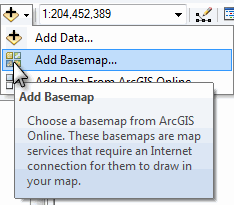
  • ArcGIS Online this is actually very easy to use but NOT to be used for long term GPS management and only works with an internet connection. If you are just looking for a quick GPS import or to make a mash-up with your tracks. Below is an interactive map with some of my favorite running routes.

Data Management

The MapSAR team has adapted many GPS data management techniques from the National Wildfire GIS Standard Operating Procedures - but we are open to any tips and tricks you all might have as well.
  • Using GIS in WiSAR text discusses GPS data management in detail in Chapter 6: Integrating GPS and Current Technologies into SAR Operations 
  • Folder structure used by George Durkee - this has not been adopted as a standard but might be helpful starting point. From George "I've created a stripped down version of the MapSAR folder structure by removing the MapSAR for ArcGIS 10 files. This keeps a logical folder structure along with suggested naming conventions that Paul developed. It also includes the Excel file 2013_SAR_GIS_FILE_NAMER.xlsx Vanessa did. This customizes and standardizes file and folder naming for anything you need on a SAR. If you're not using MapSAR, the folder structure is pretty darned good for organizing not only your SAR files, but gives you an idea of how to organize all your geospatial files."
  • MapSAR can connect to a GPS directly if tracks are stored on an SD card, very easy to use with Edan Cain's GPS Add-in that comes with MapSAR. Either way - once GPX files are accessible, this tool is the best way to get your data into a geodatabase. Watch video here. To export to GPS tracks - you CAN export to .kml and use software that allows .kml to the GPS receiver.
  • IGT4SAR similar to MapSAR, but specific to IGT4SAR is the ability to determine a theoretical Probability of Detection from the GPS track. This provides a verification for the estimate of POD provided by the teams. IGT4SAR allows for native feature to .gpx. See comments from Don below.
  • Feature to GPX Add-In (by Kevin Hibma) for ArcMap can be installed, but you need to convert polygons to line first . There is an open ArcGIS for Ideas open on the topic and you can go here to vote for it's implementation. 

Training and Cheat Sheets

Since so much of what we are trying to do in SAR has already been done by the fire service - Kathy and Lorri have forwarded some more helpful resources for your team.


  • GPS Training from NWCG The class that Kathie Hansen developed and continues to maintain. 
  • GPS Pocket Cards have tip sheets for the following Garmins:  MAP62, 60CS, 76CS, 76S, Montana, and Oregon  If you have a Rhino it is very similar to the 62
  • GPS for Download Tag George says "This form is intended for use as SAR teams turn in their GPS. You fill out the form of the team, then put it and their GPS in a plastic bag for later download and keeping track of their GPS. The team can either be debriefed or go get food. Also attached is WAYPOINT FORM_Draft2.pdf. This is for field teams to fill out when they establish a waypoint (clue, LZ etc.) etc. on their GPS. Turned in on debriefing, it allows the GIS person to know what the Wapoints are they download."
No GPS? No dinner!


Well - this is a start. Please send more resources to the SARGIS Discussion Group and/or make comments below. 


Tuesday, October 22, 2013

Search and Rescue GIS Resources for Canada


After our recent MapSAR Training event at SARScene Canada 2013, Rick Laing of Ridge Meadows SAR, Elaine Girrior of Yellowknife SAR, and Peter Devanney of SAR Global 1 agreed to put together a shortlist of resources to start discussion and establish SARGIS collaboration across Canada. Here is what we have put together (this information may be useful even if your response area is outside of Canada).


Basemaps

With regards to basemaps there are many resources available to you already while connected to the internet. For instance, below is a map of all of the Community Maps Program participants who adding even more detail to the World Topographic basemaps. Also within ArcGIS Online and ArcGIS Desktop you have access to the basemap produced by the Open Street Map program. 


View Larger Map

To open these in ArcMap simply use the add basemaps function...

Here is a snapshot of some highly detailed data for Coquitlam 


Base Data

There is a whole section about how to organize your Minimum Essential Data in the Using GIS for Wildland Search and Rescue textbook (free download) and also in an earlier blog post "Pre-planning is half the battle". Base data can be tricky for new GIS users because these datasets tend be rather scattered across the internet and are hard to track down if you do not already work with a GIS Specialist. But we thought we would point out some Canada-specific data sources for all of you here.  

In many cases this will require you to download the data in various formats, unzip the data, add it to your map, and style it appropriately. 

Creating a layer package clipped for your specific area is a great way to keep these data portable and organized. When you unpack them they keep your geography and symbology and can be stored locally, on a portable drive, and ArcGIS Online.


ArcGIS Desktop for Nonprofit Organization Program by Esri Canada. Go to the website and Request Application for Membership

  • $100 for ArcGIS Desktop (administrative fee)
  • Designed for small ground SAR organizations in Canada 
  • Organization can not be a Nationwide and/or Government owned agency
  • Community Based Non Profit Volunteer Organization (with or without a CRA#)
  • Must be associated with SARVAC, CASARA, or Northwest Territories
  • CRA Charity registration number - not needed, simply note your relationship with SARVAC


Download MapSAR template for ArcGIS Desktop from www.mapsar.net

MapSAR is a free tool that runs with ArcGIS 10, 10.1, and 10.2 to store geospatial information, enabling SAR maps to be generated, stored, and printed quickly so that search teams can get out the door faster to look for the missing person.


Join our Discussion Group!

A group for National Park Rangers, Sheriffs, Mountain Rescue Associations and other emergency service people to discuss and help others use and implement GIS (Geographic Information Systems) technology in SAR (Search and Rescue), emergency and day to day operations. Central to our group’s goals is to make GIS techniques and technologies more accessible to non-specialists. Towards this end, we have continued to explore techniques and technologies that can create a more streamlined workflow and effective situational awareness when using GIS. 

What's next?

From here we hope the real discussions can begin. 

  • Should there be a Canada SARGIS User Group? 
  • Where will the next MapSAR Training be? 
  • How can base data and even pre-planned operational data be stored and shared for teams to utilize (see example)?
  • How do I meet local GIS Specialists and work with agencies already using GIS in my area? 

In the meantime, please do visit the NAPSG MapSAR and IGT4SAR for online training videos and stay informed via the SARGIS Discussion Group. Don just uploaded a video that highlights the importance of minimum essential datasets and breaks down some GIS basics here in this video: http://www.youtube.com/watch?v=qdOM9RsQ1ZI

Let's continue the discussion and collaborate around this topic. 

Tuesday, October 15, 2013

A Remedy for Your Basemap Blues

Problem: Slow Maps

So you are on a search and rescue mission using ArcGIS Desktop and while panning and zooming around the map, you are continuously waiting for basemaps to "re-draw". You can't guarantee an internet connection so you want to utilize your local data.


 Solution: Basemap Layers

Some nerdy GIS talk from the help documentation: "Basemap layers are a kind of map layer that provides a framework onto which you display your dynamic operational information. Basemap display performance is very fast. Since basemap layers are relatively static and do not change frequently, their display can be computed once and reused many times. The first time you visit an area at a particular map scale, basemap layer display is computed. The display is recalled on return visits to that area and map scale."

It is FAST! So let's get started.


Step one - Cartography

So this step will vary based on what you use as basemaps for your area. A long time ago Liz Sarow from Esri showed me how to make a nice hill-shaded topo from publicly available data. For California here are some resources:

1) Topos available as Digital Raster Graphics
2) 30m Digital Elevation Models available as Images (or these can be made with any DEM using the Hillshade tool)

The next trick is to add these to your map and style appropriately. I personally use a hillshade-on-topo "sandwich" - but I set hillshade properties as transparency of ~55% and Resample to bilinear interpolation.


Map sandwich!


Step two - Add a New Basemap Layer

Right-click the data frame name in the table of contents and click New Basemap Layer.

Adding a new basemap layerThe new basemap layer in the table of contents

Step three - Select the Layers 

Select the layers that will comprise your basemap and drag them into the basemap layer.Now you have a topo map that also highlights the terrain in your area - more importantly we can now pan and zoom around the map without waiting for redraw.


Please see the help document for more information. You can download my example as a tile package here and the try the steps above.


Other recommendations

  • Create these and store them for your areas of operational responsibility so they are ready to go ahead of time. These can be stored locally and remotely using Dropbox or ArcGIS Online.
  • Do not add any vector layers to your map that you plan on tracing for editing or clicking for attributes - this removes data access. No big deal if you do, just remember to pull the layers back out of the Basemap layer when you need them.
  • Whenever possible - use ArcGIS Online basemaps, they render quickly and feature more often updated content than your old topo and trail maps. See the World Topo Community Basemap and Open Streetmap 
  • RTFM Read the Free Manual: there are lots of other tips & tricks you can use in the ArcGIS Help documentation. Also - join our discussion group and ask the SARGIS geeks yourself! 


Wednesday, August 21, 2013

NAPSG & MapSAR Virtual Training: Wildland Search and Rescue


For more information and sign-up visit the NAPSG link directly: http://events.r20.constantcontact.com/register/event?oeidk=a07e815v7w25372c4c4&llr=nplxpbdab

Saturday September 14, 2013 from 12:00 PM to 1:00 PM EDT
Add to Calendar 

Please join NAPSG Foundation and our partners at MapSAR for a special training session on the MapSAR geospatial tool set. Maps are at the core of any Search & Rescue operation.  MapSAR, a combination of maps and GIS technology, helps us to conduct operations so that search teams get out the door more quickly, find those who are lost, and bring them home safely.

Experienced SAR instructors, GIS specialists and NAPSG are excited to offer this no-cost training seminar to show how public safety can incorporate MapSAR geospatial technology into the public safety mission.  Take this opportunity to learn first-hand from SAR members who have successfully used MapSAR in the field to complete their mission.

The purpose of this training is to:
  • ·        Introduce how SAR and other public safety operations can benefit from GIS.
  • ·        Introduce the MapSAR software (a free download).
  • ·        Learn how MapSAR can help with planning and mapping within ICS operations.

While MapSAR is designed for the wildland environment, this training session is not limited to wildland responders.  At NAPSG's recent Northeast Summit, MapSAR was successfully taught to a wide mix of public safety officials - including urban SAR, structural fire, and law enforcement personnel.

Sunday, December 9, 2012

Pre-planning is Half the Battle

Here at the MapSAR Training in San Bernardino there have been a lot of meaningful sidebar conversations. Speaking with a member of Ventura County SAR, I felt like it was time to open a broader discussion on Search Operation pre-planning. We want to know, what types of geographic features you are using on operations?

Here is a list we discussed:
  • Roads
  • Trails
  • Trailheads
  • Streams
  • Powerlines
These are just some of the datasets that should be included in your Minimal Essential Dataset (MED) and could be used for planning search segments in advance of an incident.

Image

However, over the past year our Using GIS in WiSAR group have been tinkering with the use of Watershed Boundaries for the use of planning areas or even starting points for segment delineation. 

*UPDATE* March 3rd 2017

Why watersheds?  "It is evident that the topography affects how people move through their environment, so instead of looking at how far they travel in a straight line from where they were last seen in order to predict where to look for them, perhaps it would be better to analyze the topographic features around them. One way in which to do this is by analyzing their movement between watersheds." - Read more in Jared Doke's MS Thesis.

This has been further supported in research by Elena Salva in a research article titled: Evaluating Lost Person Behavior Models

Now that the latest National Hydrological Dataset has been released, it would be a good idea to download the dataset and add it to your MED.

Image

Then you can use some of the editing tools, such as cut polygons to begin breaking down the watershed boundaries into searchable segments by other features such as roads and trails.

EditorCutPoly

This is a big breakthrough for Using GIS in WiSAR and researchers Jared Doke, Robert Koester, Don Ferguson, and Charles Twardy are testing these watershed boundaries against/with Lost Person Behavior models for determining Probability of Area. In addition Lori Peltz-Lewis will be working with GISCorps to make sure SAR Teams in California have this and other datasets for their MED.


I hope this post sparks discussion on pre-planning and discuss what others are doing or will do to prepare for their next search.

For those of you "North of the Border"....Here is a watershed data source that was forwarded to me today for Canada. I have not taken a look yet, but feel free to check out the
link.

http://geobase.ca/geobase/en/data/nhn/description.html

NHN dataset (Nation Hydro Network) that NRCAN provides. It has 1:50k data (interpolated from coarser data where finer data is not available) standardized across Canada. In some regions, the provinces have partnered up to provide better quality data and rely less on the
general computer model to compute the data.

*UPDATE* March 3rd 2017

The USA Watersheds are also available in ArcGIS Online for use in web maps, apps, and ArcGIS Pro through the Living Atlas of the World program. You can test this in the web mapping app embedded below.

Thursday, December 6, 2012

"Clip Before You Go"


Today I spoke with Brian Quinn, a GIS Analyst for the County of Marin, California. We were discussing how he can support Marin County SAR as they begin implementing MapSAR and building out Minimum Essential Datasets. On the one hand most vector data can be collected ahead of time and stored as geodatabase and/or layer packages. But sometimes you need to quickly grab new data on the fly. Together, we thought of a really quick way the Marin SAR Team could use Free and Public ArcGIS image services to clip raster data (basemaps, elevation models, imagery) before leaving the office.


Here is what we tested in ArcGIS Desktop.

Image

  • Next Zoom into an Area of Interest and open the Image Analysis Window


ImageAnalysisWindow

  • Then use the Clip and Export buttons to grab the data you need


ClipAndSave

  • Finally, use your Using GIS for WiSAR textbook to figure out the best practice for adding this to your Minimum Essential Dataset (MED) within the MapSAR folder structure


SaveIt

These clipped rasters will now be available when you disconnect and can be added to your MapSAR document and printed on your maps. There will be size limitations but for most incident specific extents this should work. In the long term, you will need a more holistic approach to Data Management. See the Using GIS for WiSAR textbook.

For more information, see the Help on the Image Analysis Window. For another example of imagery deployed via free web services see the California Department of Fish and Game Map Services website.

This is just one of many ways you can collaborate with your local GIS Specialist. Most GIS Specialist are pretty friendly and eager to help because they likely found their profession in GIS by looking for meaningful work and making a difference. If you do SAR work, you likely have something in common. So - give them a call, buy them a beer, invite them to a SAR meeting, and send them to our SARGIS Discussion Group!

Tuesday, December 4, 2012

“But I don’t work in a connected environment!”


Over the past year we have worked with Search and Rescue (SAR) volunteers at various training events (NASAR / MRA Conference, National SAR Academy, California SAREX, SARScene Canada) and presented on the topic of Using GIS in Missing Person Search Operations. We have been using a particular fictional case study – the Clark SAR – to practice new workflows built on the principles taught in Using GIS for Wildland Search and Rescue and for testing upgrades to MapSAR (an ArcGIS Desktop template designed for SAR, go to www.mapsar.net for more details).

Here is the scenario.

“The Search and Rescue team in Yosemite National Park, California has received a call about a lost hiker who was last seen at the Sunrise High Sierra Camp. He was scheduled to meet his companions at Vogelsang High Sierra Camp last night at 8 pm but never arrived.  Today, at 07:00, they reported him missing.  His companions said his travel plans were to hike from Sunrise to Merced Lake High Sierra Camp and stay overnight; and then hike the following day to Vogelsang High Sierra Camp and stay the night.”

Lesson 1: You can/should have your data organized in a way that supports both connected and disconnected workflows

First of all, when a report comes into the Ranger or County Sheriff office, most likely you are sitting in front of a web browser. To plot the point last seen or initial planning point you can use an ArcGIS Online web map like below.

[caption id="" align="aligncenter" width="580"]Image ArcGIS Online Web Map for editing Initial Planning Points for situational awareness across organizations.[/caption]

With the new geoservices added to the locate tool in ArcGIS Online and the new design to the ArcGIS Online World Topographic Map it is easy to find an area by points of interest. If I already have an editable feature service for Missing Subject Information I can quickly enter essential information right on the map.

[caption id="" align="aligncenter" width="436"]Image Editable feature services like this could be hosted by County, State, or Federal agencies so First Responders and SAR Volunteers can quickly document missing person information.[/caption]

Now I will add some trail data to the map by searching ArcGIS Online, add a map note of the initial search area, and upload the first hasty search team GPS track to my map by adding a gpx file directly to my web map.

Before I leave the office for the Incident Command Post (ICP), I will need to download my Minimum Essential Dataset for Search Operations for use in ArcGIS Explorer Desktop and ArcMap with MapSAR just in case we do not have internet connectivity at the ICP and we do not find the missing person right away.

[caption id="" align="aligncenter" width="580"]Image Minimum Essential Datasets are discussed in the Using GIS for Wildland Search and Rescue text (free download from www.MapSAR.net).[/caption]

Lesson 2: You can collaborate with an intermittent or improvised connection

Now, while I am at the Incident Command Post (ICP) the Chief Ranger and the State Emergency Management Agency can see my initial planning map. A GIS Specialist trained using the MapSAR User’s Manual can see this map as well and begin working on assignment maps and spatial analyses.

[caption id="" align="aligncenter" width="580"]Image Here an ArcGIS Online Group is being used to manage GIS data and applications for managing a search operation.[/caption]

At the ICP, I am waiting for internet connectivity, but still working on tracking clues as they come in over the radio plotting them by their coordinates, gps files, or geotagged photos using ArcGIS Explorer Desktop.

[caption id="" align="aligncenter" width="580"]Image ArcGIS Explorer Desktop is a free and easy to use GIS-based software that is useful in the initial planning stages and throughout a SAR Operation for situational awareness.[/caption]

When the first Operational Period is over I can share all of the operational data as a layer package with my GIS Specialist through ArcGIS Online or an email – if internet connectivity is still an issue I can send a thumb drive to the office (or coffee shop with WiFi) and have someone upload it from there. In exchange – the GIS Specialist has sent me a large format briefing map, the Day 2 assignment maps, and even created an Incident Action Plan (IAP) web map.

[caption id="" align="aligncenter" width="580"]Image Here is an assignment produced by Don Ferguson via remote collaboration during a table top exercise last month.[/caption]

With assignment maps like these I can get teams out into the field with timely and accurate information!

[caption id="" align="aligncenter" width="580"]Image This IAP map can be accessed from anywhere with an internet connection using a web browser or ArcGIS Online Mobile Applications.[/caption]

Lesson 3: Plan for the future or you won’t be ready when the future happens

At the end of Day 2, we have not found the missing subject. However, we have a few clues and investigative leads that help us prioritize our search area.

In addition, because we have created a detailed IAP map the Chief Ranger and State Emergency Management Agency have agreed to send us more resources. However, with more boots on the ground and helicopters in the sky, more data flows through the Incident Command Post. A GIS Specialist is en route to the ICP to help with data management and cartography using MapSAR. Meanwhile, a remote GIS Specialist continues to produce probability models based on the data coming in. All of this was made possible because we leveraged a centrally managed ArcGIS Online account meant to prototype a Federal or State Agency with volunteer SAR Team as members.

[caption id="" align="aligncenter" width="580"]Image Here is a prototype ArcGIS Online Account that could be used by Emergency Management Agencies to support volunteer SAR Teams with Minimum Essential Datasets, Incident Groups for sharing data and maps, and editable feature services for up to date reporting.[/caption]

While this is just a training scenario, what he have learned is already being put into practice in the United States and Canada, join the SARGIS Discussion Group to find out more. Working in disconnected environments can be a major challenge for communication in all aspects of operations but that does not mean you do not have access to professional GIS tools and personnel. Subscribe to the Esri Public Safety Resource Center as we add more disconnected mapping applications and tools to simplify GIS workflows in the future. If you are a volunteer SAR Team, visit the Nonprofit Organization Program for more details and stay tuned for an announcement related to getting professional GIS help for your SAR Team. Are you ready for the future of Search and Rescue?