Showing posts with label MapSAR. Show all posts

Friday, March 8, 2019

Lesson: Prepare for Search and Rescue Incidents


After a few years of teaching how to deploy MapSAR Online,Alix Vezina and I decided it was time to open up the no-cost training to a much wider audience. 

In this lesson, you'll create a web map to prepare data for search operations. Your map will contain static base data showing regional boundaries and key features, as well as editable layers that can be changed as an incident develops. Then, you'll use the map to create a web app that even non-GIS professionals can use. Finally, you'll use the app to track a fictional SAR mission.

We worked with the Learn ArcGIS team to produce a lesson that walks you through the following steps:

Create a mapCreate and configure a web map with base and incident data.30 minutes
Create an appCreate and configure a web app with tools to support search operations.1 hour 15 minutes
Map a search operationUse the app to map a fictitious search and rescue operation as it happens.1 hour 15 minutes
This will give a GIS professional a basic understanding of search and rescue OR a SAR professional a basic overview of how ArcGIS Online works. The app you create is using Web AppBuilder for ArcGIS

We plan to do follow up blog posts on topics:

- Integration with ArcGIS Pro 
- Integration with Survey123 for ArcGIS
- Integration with SARTopo
- Archiving Incidents 
- Spatial Analysis
- +More

Friday, February 17, 2017

Presentation to MAGIP on SARGIS

Event

On February 8th, 2017 the NAPSG Foundation provided a virtual workshop for the Montana Association of Geographic Information Professionals (MAGIP) and local search and rescue team members.  While MAGIP attendees attended on-site (Bozeman, Montana), they also extended the invitation to the Public Safety GIS and SAR Community to attend via WebEx. You can watch this presentation here via WebEx video.

The objective of this presentation was to foster exchange between the Geospatial Professional and Search and Rescue Communities by providing an overview of capabilities with geospatial decision support tools and building a common language. 


We feel we have achieved this objective. As a result of this event, the local SAR Teams and GIS Professionals plan to meet more regularly, share data, and train on using geospatial decision support tools for search operations. In addition, the audience agreed they would like to participate in future SARGIS workshops, including the 9th Annual Search and Rescue GIS Workshop (SARGIS9 - November 2017, Rocky Mountain Region). 


Resources

We used the SARGIS8 Training Story Map to guide the presentation and discussion. This website includes downloadable tutorials and interactive examples to show your local SAR Team. You can access this free training resource here: http://bit.ly/BasicSARGIS


In addition, the case-study we used to kick-off the event was based on a group of photographers who were stranded in the mountains north of Bozeman, Montana. Geospatial intelligence was critical in this mission and the Story Map allows us to review the mission and learn from it.  You can access this interactive Story Map here: http://arcg.is/2lmtuaC


For information about GIS for Search and Rescue and to begin developing geospatial decision support tools for your SAR Team, see the Wilderness Search and Rescue Capability and Readiness Assessment Tool (CARAT).

Special thanks to Curtis DeVault of MAGIP, Angela Pervél of NAPSG Foundation, and Don Ferguson SARWG Co-chair for helping to make this event possible despite my crazy schedule and presenting remotely from New Zealand.

Wednesday, November 4, 2015

SARScene 2015 and Washington DC Trip Report

As I fly back to California, I reflect on a fun and productive week and a half.


Last week I attended the 2015 SARScene in Prince Edward Island, Canada. On Thursday, I helped Norman Deschamps teach a workshop on SAR Explorer (SARX) which had students from multiple provinces. All students agreed they will use SARX for future operations and want to learn more about MapSAR and IGT4SAR for advanced mapping. Norm really broke it down and made it easy to follow, great course.


Then on Friday night, I helped "Team SAR" put together some solutions for combining an online / offline platform for hasty search response. This included a wireless server that can work without internet for signing in volunteers and providing them with a pdf map. When they return within range of the wifi router, it will automatically grab their gps track data. This solution was named "Blue Diamond" and created by Michael Coyle, Thierry Des Trois Maison, and Cameron Dykeman (the night shift). Agata Lawrynczyk built her first ever web mapping application (using ArcGIS Online Web AppBuilder) which contributed to MapSAR Online version 4. This app allows you to very quickly plot the initial planning point, draw an assignment, and print a map. Very simple, but very useful. In the end "Team SAR" won the hackathon!


The GitHub repositories for each solution are public here:
  • Blue Diamond https://github.com/SARscene
  • MapSAR Online https://github.com/pjdohertygis/MapSAROnline
MapSAR Online can produce a quick map and connect first responders with GIS Analysts working remotely.

After a traditional maritime "kitchen party" on Saturday night in PEI, I said farewell to my Canadian counterparts, and continued on to meet with colleagues from the National Alliance for Public Safety GIS Foundation in Washington D.C. There we met with representatives from the FEMA Urban Search and Rescue Team and the National Association for Search and Rescue. As an outcome, the NAPSG Search and Rescue Workgroup now has an informal partnership with FEMA and NASAR to share best practices and hopefully form a more strategic partnership in the future to support the development of standard operating guidelines, symbology tools, and training. 

Needless to say, it was a big month for GIS in SAR. More announcements to follow at SARGIS7, see some of you there!

Tuesday, October 13, 2015

SAR Mapping Course @SARSceneCanada

For those of you who are going to Canada's National Search and Rescue Conference in Charlottetown, Prince Edward Island October 22-26, 2015, (SARScene) we just want to give you a heads up that there will be a workshop on Thursday, October 22 devoted to mapping and GIS specifically for search and rescue location data management. The course includes almost three hours of hands on tutorial with SAR Explorer (SARX), as well as demonstrations of using MapSAR and ArcGIS online for more collaborative SARGIS data management efforts. 

The description of the course, and a link to the course description on the SARScene 2015 website are at the end of the post. There are still about a half dozen spots available in the workshop, so if SAR GIS is your thing, don't miss out!

SAR Mapping - http://www.sarscene.ca/2015/training_e.asp
It is not too late to sign up for SARScene - Registration Page / Renseignements

In this course we will share best practices for using mapping technology and the power of geographic information for both short-term and long-term search operations. We will discuss three technology options in detail and you will learn some hands-on skills. This course is a great opportunity to learn how to use software that provides virtually everything a team needs to mange spatial information during a search operation. Even if your team has already chosen to use a different mapping platform, this session will still be valuable as a way to expand your knowledge on efficiently managing GIS (geographic information system) data during a search.

Instructors:
  • Norman Deschamps - Search Manager and GIS Analyst, Tri-County Ground Search and Rescue Association, New Brunswick
  • Paul J. Doherty, PhD - WiSAR Specialist, National Alliance for Public Safety GIS Foundation
Location: Rodd Charlottetown - Georgian Terrace
Time: 8:00 - 16:00
Norman Deschamps, creator of SAR Explorer
Paul Doherty, SARGIS enthusiasts

Wednesday, July 2, 2014

USGS Historical Topographic Map Explorer for Search and Rescue

While we always want to use the most up to date maps (a Local GIS-produced basemap, World Topographic, Open Street Map)  for our missing person search operations - there are times when historic maps are necessary for our investigation. For instance what if your missing person was believed to be carrying a historic map - you might want to interpret the landscape through the same map they were using. 

This dynamic map allows you to view and download historic quad maps based on location - this could be a very useful tool for Search and Rescue in the US! 

Check it out: USGS Historical Topographic Map Explorer

1) Type in a place and click on the map
2) Click timeline maps to view in main window

3) Slide transparency on map to compare, or drag/drop to re-order maps


The downloads appear to be available as geo-pdfs only - but these may be converted to more GIS friendly formats (.tif). I look forward to hearing if any teams have used this resource and any feedback they may have. 

If you simply want a seamless USGS Topo - this is already a layer in ArcGIS Online that can be used as a basemap in ArcGIS Desktop or ArcGIS Online while connected to the internet.


View Larger Map

If you are looking for the USGS topographic maps to run locally in ArcMap - most states have a download page for pulling the digital raster graphics (DRGs). I have also heard that Matt Jacobs from CalTopo can show how to use the seamless tiles he has produced inside your GIS. 

However - basemaps should always be suspect to currency and  used in conjunction with your local minimum essential dataset (read Chapter 3).

Thanks USGS for making data open and easier to find!

Wednesday, May 28, 2014

MapSAR Training - Ft. Smith, AR

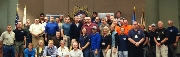
This training event was a success! GIS and Public Safety professionals from three adjacent states (MO, OK, AR) learned how to use GIS for Search and Rescue - but more importantly they were all in the same room together meeting face to face.

After dealing with some serious weather related obstacles during my trip (diverted to College Station and spending the night in Houston), I finally made it to Fort Smith. Luckily Mark, Marcus, and Caroline were ready to present the tutorial and get started without me.


On Day 1 we covered the Yosemite Search tutorial and helped everyone get familiar with the MapSAR interface. Once students had their initial setup configured they were off and running - making their first maps. Who knew unzipping folders could be so much fun?


On Day 2 - Wes Cleland presented a local fictional search scenario that would involve a multi-agency response and the students had to respond with MapSAR on their own. This reinforced what was taught on Day 1. We also covered the overall topic of using GIS for SAR with local media in attendance which was a great opportunity to do some outreach. 

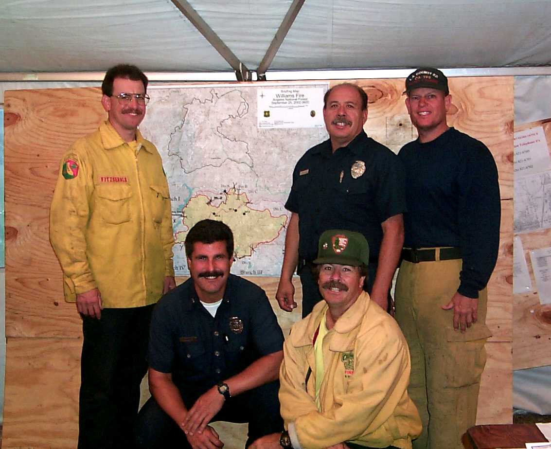
Finally, in the afternoon Wes reviewed a recent missing aircraft / pilot search with a very personal and thoughtful tone. He explained some of the challenges they faced and what was learned during this process. ArcGIS online was used during this operation to collaborate / coordinate planning and operations - but not until the search was well underway.


This led to a great discussion about how to better prepare for search operations. All in attendance agreed a follow up meeting is needed to outline the core workflows (define search boundary, segment the map, make common maps available to general and command staff) and information products required for search operations. It is also important to draw commonalities with disaster response, such as the recent tornado in nearby Mayflower / Vilonia, Arkansas. For me, getting to see this in person was very compelling.


Key lessons learned:

1) Have incident templates and minimum essential datasets ready to go before the incident. This seems obvious but experiencing the time wasted in the process made this very clear.

2) We need to create a visual information product "menu" that non-GIS responders can choose from early on in search operations then order the resources needed to create them (investigators, experts, GIS staff). This will help prevent information overload or misuse of resources.

3) There is a great deal of potential for using cellular phone / tower for search operations - but a synthesis of how to use this information is not (yet) available to the community. 

I am sure those of you in attendance have your own thoughts and I'd love to hear them in the comments below.

Thank you to the students and their agencies, the Esri Disaster Respinse Program, the Esri St. Louis Refional Office, the University of Arkansas, the GISCorps, and the National Alliance for Public Safety GIS for making this possible. 


Monday, December 23, 2013

The State of SARGIS in 2013

2013 was a great year and the SARGIS Membership has grown to +500 members! 
See the live map and add yourself by entering your coordinates


Let's take a look at some highlights from 2013 (let me know what I missed):


January the GISCorps began a pilot project to train their members in MapSAR and ArcGIS for WiSAR 

February Great discussion on the use of timelines in SAR planning

March IGT4SAR Tabletop exercise and training in Morgantown, West Virginia - Jared Doke released his MS Thesis on Lost Person Behavior in Yosemite - GISCorps MapSAR Training in San Jose, CA

April 5th Annual SARGIS Meeting in Denver, Loren Pfau presented on his graduate work - MapSAR Training in Bellevue, Washington - Don Ferguson gave a lecture on SARGIS at George Mason University 

May Paul Doherty defended (successfully) a SARGIS dissertation at UC Merced

June Rick Laing shared his research on Missing Person Data for Alzheimer Patients in British Columbia. Sierra Madre SAR teaches MapSAR at the MRA Conference in Arizona.

July the second SARGIS User Group meeting was held at the Esri International User Conference

August NAPSG SARGIS Training in Connecticut

September SARGIS is presented at AFAC2013, Melbourne Australia - MapSAR is adapted by NSW and Victoria Rescue teams in Australia. Sierra Madre SAR teaches MapSAR at SAREX in Santa Cruz County, California.

October MapSAR is updated for 10.2 - MapSAR Training & Presentation at SARScene2013 in Chiliwack Canada

November Training videos for IGT4SAR and MapSAR are released. George Durkee taught online classes at Columbia College (GIS Essentials for SAR and Agency Operations) and hands-on coursework as well.

December CalOES agrees to recognize the GISCorps MapSAR Trained volunteers as State mutual aid resources! There will be a swearing in, early 2014.


Marcus Kitchens and myself standing in front of Don Ferguson's Travel Cost poster at the Esri UC

Finally, many of you were involved in supporting SAR missions on-site (US, Canada, and Australia) and remotely. Some of note are the Conn, Greene, and Lagrée


What would you like to see in search and rescue GIS in 2014? 

  • Organization: A more formal SARGIS organization? A non-profit body? Or continue to remain a discussion group?
  • Training: More on-site training? More online training? More training videos? More training manuals? More Field Guides / SOPs?
  • Discussion Group:  Would you like to remain on the Google Group discussion list serv? Any suggestions for another forum? 
  • Platform:  As we see more use of web mapping and ArcGIS Online in emergency management, is that something you all want to know more about? How about connected / disconnected workflows? The integration of other devices?
  • Assistance: Should we continue to discuss active search operations in the Discussion portal? If so - should we assign roles to make sure information is kept clear and concise?
  • Research: There are many great research activities going on? How should we continue to formalize this and make sure the link between academia / field is strengthened?
  • Annual Meeting: Where shall the 2014 SARGIS Meeting be held? Remember our spatial requirements (<30 miles from a microbrewery and a National Park).
I am very curious to what you all have to say! 

Photo from one of our first meetings, Yosemite Valley 2010
No matter what we do, remember to recognize all of the hard work that has gone into this SARGIS movement. MapSAR, IGT4SAR, SARGIS Best Practices material, are all done by VOLUNTEERS! Without the partnership and support from government agencies (NPS, NSS) and other NGO's (GISCorps, NAPSG, MAPS) - none of this would be possible. If you want to help put together a training event or Regional meeting, please do offer your assistance. 


MapSAR Training in San Bernardino, December 2013


A SARGIS Legend moves on...to Grandpa Land!


On a related note, I am sad to say - Tom Patterson will be retiring from Esri to focus on what is most important in life, being a grandpa : ) Tom has spent his entire adult life trying to help others in the world of wildland fire and search & rescue. Thank you for your service Tom, the words GIS and SAR would probably still not appear in the same sentence without you. I hope we can continue to make you proud and best wishes in your well deserved retirement.

Friday, December 6, 2013

MapSAR Training in New Mexico

Learn how to use MapSAR and GIS for Search Operations

MapSAR


Participate in the first MapSAR Training in New Mexico! The training is designed to help participants learn how to use MapSAR – a GIS (Geographic Information System) application – for improving Search and Rescue (SAR) efforts. Prior GIS experience is not required to participate in the training but we recommend strongly that those without GIS experience complete ESRI’s free ‘Getting Started with GIS’ web course prior to attending the training. The MapSAR Training is composed of three parts:

  • Friday, 01/17/2014, 1530-1700: Seminar, GIS for Search and Rescue
  • Saturday, 01/18/2014, 800-1700: MapSAR Tutorial, Yosemite National Park Scenario
  • Sunday, 01/19/2014, 800-1700: MapSAR Workshop, New Mexico SAR Scenario 

The seminar on Friday is open to the public. However, registration is required for the trainings on Saturday and Sunday and space is limited. So, register now by submitting the attached form! 

Cost: $0; computers, software, and training materials will be provided 
Location: New Mexico State University, Breland Hall 185 & 194, Las Cruces, NM 88003 Contact: Michaela Buenemann (elabuen@nmsu.edu) for registration details

Due by December 15th, Go to the Registration Page

Participants will be selected from all registrants to ensure that the class is composed of SAR team members from across New Mexico as well as a mix of people with SAR and GIS knowledge and skills.  If vacancies occur, participants on the waiting list will be notified at a later time. See the NM SAR Council Calendar page.


Monday, December 2, 2013

GPS for SAR Resources


Now what?
Lately, I have received many requests for GPS Training, Tips, and Tricks for Wildland Search and Rescue. 

Lorri Peltz-Lewis (USFS), Kathy Hansen (NPS), George Durkee (NPS), Tim Smith (NPS), Kevin Davis (NPS), Edan Cain (Esri), Bernie Szukalksi (Esri), Ian Batley (Mapping and Planning Support Team - MAPS), the Open Street Map Team, Don Ferguson (IGT4SAR) and Jon Pedder & Arnold Gaffrey (Sierra Madre SAR) have all pitched in and shared their ideas. So I thought I would compile these here. Thank you all for your comments!


Downloading

There are many options, but I thought I'd list the ones that were most recently discussed. Most of the SAR Teams I have worked with use Garmin GPS - but the bottom line is any GPS Receiver / smartphone should be able to create gpx files which are inter-operable with the solutions discussed here as well as proprietary software like Terrain Nav Pro, Maptech, etc.
  • DNR Garmin  is free and has been used by Wildland Fire GISS for many years. It has a small learning curve but allows for direct connect to GPS and directly imports / exports to ArcMap. This is still the best option, in my opinion. Here is a short video by George Durke. 

  • GPS Babel is also free and does everything DNR Garmin does and more... steeper learning curve for sure
  • Garmin Basecamp free and easier to use than most other GUI I have seen. Obviously only works to connect with Garmin units. This may be the best solution when you want to split GPS / GIS tasks and are limited on GIS trained staff.
  • ArcGIS Explorer - Edan built this tool a long time ago and ArcGIS Explorer has native GPS support in it's final release AGX 2500.
  • [Updated] Open Street Map is another way to map your GPS tracks and also contribute to basemaps that work across platforms, including ArcGIS Online and ArcGIS Desktop. Download the ArcGIS Add-in to download vector data and work disconnected with this resource: ArcGIS Editor for OSM.
  • [Updated] EasyGPS I have not used this yet but it looks promising and has good reviews from our 'mates down under. The website says "EasyGPS is the fast and easy way to upload and download waypoints, routes, and tracks between your Windows computer and your Garmin, Magellan, or Lowrance GPS. EasyGPS lists all of your waypoints on the left side of the screen, and shows a plot of your GPS data on the right. Use EasyGPS to back up and organize your GPS data, print maps, or load new waypoints onto your GPS for your next hike or geocaching adventure. EasyGPS works with every popular handheld GPS receiver, and it is 100% FREE!"
  • ArcGIS Online this is actually very easy to use but NOT to be used for long term GPS management and only works with an internet connection. If you are just looking for a quick GPS import or to make a mash-up with your tracks. Below is an interactive map with some of my favorite running routes.

Data Management

The MapSAR team has adapted many GPS data management techniques from the National Wildfire GIS Standard Operating Procedures - but we are open to any tips and tricks you all might have as well.
  • Using GIS in WiSAR text discusses GPS data management in detail in Chapter 6: Integrating GPS and Current Technologies into SAR Operations 
  • Folder structure used by George Durkee - this has not been adopted as a standard but might be helpful starting point. From George "I've created a stripped down version of the MapSAR folder structure by removing the MapSAR for ArcGIS 10 files. This keeps a logical folder structure along with suggested naming conventions that Paul developed. It also includes the Excel file 2013_SAR_GIS_FILE_NAMER.xlsx Vanessa did. This customizes and standardizes file and folder naming for anything you need on a SAR. If you're not using MapSAR, the folder structure is pretty darned good for organizing not only your SAR files, but gives you an idea of how to organize all your geospatial files."
  • MapSAR can connect to a GPS directly if tracks are stored on an SD card, very easy to use with Edan Cain's GPS Add-in that comes with MapSAR. Either way - once GPX files are accessible, this tool is the best way to get your data into a geodatabase. Watch video here. To export to GPS tracks - you CAN export to .kml and use software that allows .kml to the GPS receiver.
  • IGT4SAR similar to MapSAR, but specific to IGT4SAR is the ability to determine a theoretical Probability of Detection from the GPS track. This provides a verification for the estimate of POD provided by the teams. IGT4SAR allows for native feature to .gpx. See comments from Don below.
  • Feature to GPX Add-In (by Kevin Hibma) for ArcMap can be installed, but you need to convert polygons to line first . There is an open ArcGIS for Ideas open on the topic and you can go here to vote for it's implementation. 

Training and Cheat Sheets

Since so much of what we are trying to do in SAR has already been done by the fire service - Kathy and Lorri have forwarded some more helpful resources for your team.


  • GPS Training from NWCG The class that Kathie Hansen developed and continues to maintain. 
  • GPS Pocket Cards have tip sheets for the following Garmins:  MAP62, 60CS, 76CS, 76S, Montana, and Oregon  If you have a Rhino it is very similar to the 62
  • GPS for Download Tag George says "This form is intended for use as SAR teams turn in their GPS. You fill out the form of the team, then put it and their GPS in a plastic bag for later download and keeping track of their GPS. The team can either be debriefed or go get food. Also attached is WAYPOINT FORM_Draft2.pdf. This is for field teams to fill out when they establish a waypoint (clue, LZ etc.) etc. on their GPS. Turned in on debriefing, it allows the GIS person to know what the Wapoints are they download."
No GPS? No dinner!


Well - this is a start. Please send more resources to the SARGIS Discussion Group and/or make comments below. 


Saturday, October 19, 2013

#MapSAR in Canada - Resources and Updates from @SARSceneCanada

From SAR Scene 2013, Chilliwack, British ColumbiaFor those of you interested in using GIS for Search and Rescue in Canada, we have some resources for you. 


1) Find out about the ArcGIS Desktop for Nonprofit Organization Program by Esri Canada. Go to the website and Request Application for Membership

  • $100 for ArcGIS Desktop (administrative fee)
  • Designed for small ground SAR organizations in Canada 
  • Organization can not be a Nationwide and/or Government owned agency
  • Community Based Non Profit Volunteer Organization (with or without a CRA#)
  • Must be associated with SARVAC
  • CRA Charity registration number - not needed, simply note your relationship with SARVAC

2) Download MapSAR template for ArcGIS Desktop from www.mapsar.net


3) Join our Discussion Group!


Also while at SARScene a few exciting things are happening. Rick Laing and myself just taught a MapSAR Workshop and tomorrow I will give a presentation on Using GIS in SAR and Rick will be on a SAR Technology discussion panel.

There are already talks of a MapSAR training event next year in British Columbia, location TBD (and perhaps Banff as well). 

Right now - we are integrating MapSAR with ArcGIS Online via the ArcGIS Collector and Operations Dashboard. Below is a view of the action from our web map. Stay tuned for more (including a post within the next week about how to obtain base data for building your minimum essential datasets). Please comment here or on the discussion group if you know of some great place to acquire Canadian base data (trails, roads, hydro, topo etc.) or datasets that you desperately need for your area.

Monday, September 30, 2013

#MapSAR now available for ArcGIS 10.2


Jon Pedder from Sierra Madre SAR just released a version of MapSAR that will work on ArcGIS Desktop 10.2. MapSAR for 10.2 will be posted to www.mapsar.net ASAP but it is also available for download from ArcGIS Online from the WiSAR Applications Group


For those of you interested in contributing to the MapSAR Project by testing the template or developing tools, please see the MapSAR GitHub repository. 

The goal of MapSAR is to help: 

  • Create and edit field task assignments
  • Monitor progress of assignments
  • Support logistics/communications
  • Document clues, team location and status
  • Incorporate GPS data
  • Store all incident data into a single repository
  • Create and print maps

If you are unsure if you have access to ArcGIS Software and work on a volunteer SAR Team please see the Esri Non-Profit Organization Program. If you feel you may not qualify for this program please send an email to help@mapsar.net. Free training videos are also available on the NAPSG YouTube channel.

Great work Jon and Team for getting this version out!

Also - I have added a download page for a set of ArcGIS Explorer Desktop tools here: Search and Rescue Tools for ArcGIS Explorer Desktop. Please see this page for more details.


***Update - I just updated the item page for downloading MapSAR 10.2, apparently some tools did not zip up. Also, this version can be used for 10.1 as well. 

Saturday, September 14, 2013

#MapSAR Training modules kicking off right now

Jon Pedder and Art Fortini are here at the Sierra Madre SAR Cache in California launching the MapSAR training modules via webinar: Training Announcement 

Thank you NAPSG for all of your support!


NAPSG will make the training videos available (www.youtube.com/user/napsggis)
and I will announce the location here. For those of you assisting with the flood response in
Colorado - please be safe and let us know if you need our help.

UPDATE: If you missed the event or want a recap - the slides and video are posted here: 


Monday, September 2, 2013

#MapSAR in Australia Update from #AFAC2013 and #Ozri2013

From AFAC2013 - This has been a great trip to Australia and we are not done yet. I just wanted to give an update on the agencies interested in MapSAR and IGT4SAR and the new friends that will be joining the SARGIS Discussion Group.
On Friday I will be at Ozri 2013 and next week meeting with the Queensland Police about MapSAR and training opportunities for SARGIS. I would like to thank everyone for their hospitality and please welcome our newest discussion group members.

See my Story Map for an interactive tour.