Showing posts with label SARGIS. Show all posts

Tuesday, January 2, 2018

SARGIS9 Recap

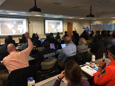
On November 6-8, 2017, NAPSG Foundation’s Search & Rescue GIS Working Group gathered with more than 50 Search & Rescue (SAR) leaders and GIS responders at the Esri Office in Broomfield, Colorado, for the highly anticipated 9th Annual Search & Rescue GIS Workshop

All resources (training, presentations, videos, etc.) have been made available here from the NAPSG Foundation website: SARGIS9 Website


The purpose of the SAR GIS Workshop was to build capacity and advance the use of location and analytics-based decision support tools across the SAR community for missing persons and disaster SAR. The diversity of perspectives and experiences generated a rich dialogue around challenges and potential solutions.


Presentations

We had a diverse array of presentations from across Local, State, Federal, and Volunteer organizations. 


  • What is SARGIS? Who We Are & What We Do [Story Map] [YouTube]
  • Role of Geospatial in Urban SAR [PDF] [YouTube]
  • MyUSNG + Explorer for ArcGIS [PDF]
  • The Role of Geospatial in the Mountain Rescue Association [PDF]
  • Case Study: Snow Leopard SAR [PDF] [YouTube]
  • Lessons Learned from Hurricanes Harvey, Irma, and Maria [PDF] [YouTube]
  • Case Study: Use of Unmanned Aircraft Systems (UAS) in SAR [PDF] [YouTube]
  • Technology Speed Geeking: Lightning Talks [YouTube]
  • Probability of Area in SAR [PDF]
  • FEMA GIS: Parcel Data for Response [PDF]
  • Maps + Apps + Rangers [PDF]
  • Taking WebGIS Maps with You [PDF]
  • I’ve got Drones…now what? Emerging patterns of UAS in SAR [PDF]

MapSAR Online

MapSAR has been a great ArcGIS Desktop (ArcMap) tool for the past decade. However, we recognize the need for easier to use tools that can be used to collaborate across organizations. That is why have started a new initiative called, MapSAR Online. 

MapSAR Online was used effectively at SARGIS9 and everyone left with the capability of providing their team with a situational awareness viewer. Here is the app we used for training - each person created a quick hasty map for their area of responsibility and learned how to build a similar app for their team. It was awesome to see the map light up with Incident Command Posts across the US within a minute of accessing the app!


As a result of this training and exercise, the SAR Working Group will be working hard to roll out MapSAR as a combined ArcGIS Pro, Online, and Field template for organizations who want to quickly get up and running with geospatial tools. In the meantime - see the training website for currently available resources.


Field Exercise 

We also had an outdoor field exercise to test the concepts of using geospatial tools for planning, operations, field mobility, and situational awareness.This was also a great opportunity to work directly with software development staff at Esri to provide feedback on field apps like Workforce for ArcGIS


Participant Map 

This was the first time we had a combined wildland / urban search and rescue theme which allowed for greater collaboration and learning. Find out more about who was there and where they are from with this Story Map below (open in a new browser window if needed).


What can you do next to help your organization? 

This basic training event was meant to give you an awareness of tools that are available and for you to self-assess your level of preparedness with geospatial decision support tools. 

Complete a Self-Assessment – Use our beta-version Tool to self-assess your agency’s geospatial preparedness, and help you measure and track your progress in building and maturing your GIS capabilities. (http://bit.ly/2e6Z9KB)

Also check out the guidance for Wilderness SAR

2 Adopt and Implement the US National Grid as a point and area reference system towards achieving consistent situational awareness across agencies and levels of government.

3 Use Standardized Incident Symbology and explore & use national infrastructure data available through HIFLD Includes standardized symbols for Search & Rescue.

4 Update or Develop GIS SOPs – Use the latest guidelines and templates to update or develop GIS SOPs for your agency to support effective incident management & coordination. (http://bit.ly/2daopgZ)


Conclusion 

This was an extremely fun and rewarding event. Best of all, thanks to the NAPSG Foundation and Esri, it was provided free of charge to participants and everyone left with new capabilities regardless of skill level with GIS. 


We would like to continue to host these events and provide tools like MapSAR - but we need your help! While our target audience has always been field practitioners and GIS Specialists, we need buy-in from decision makers to further invest in the use of geospatial tools for SAR. 
Here are some ways you can help.
1) Host a local event using the free training materials.
Stay tuned for more details on SARGIS10 and MapSAR development!


2) Speak with your County / State SAR Coordinator about the importance of geospatial tools in all aspects of search and rescue (Presentation). 
3) Join the SARGIS Community!


Monday, April 28, 2014

SARGIS6 East June 20th - 22nd


We are pleased to announce the schedule of events for the SARGIS6 East workshop to be held June 20 - 22 in Morgantown, West Virginia.  The workshop is being sponsored by the West Virginia Division of Homeland Security and Emergency Management which allows participants to attend at no cost.  The location is the West Virginia GIS Technology Center on the Campus of West Virginia University. 

Please email Don Ferguson to confirm attendance. 


View Larger Map


The workshop is being offered in conjunction with the SARGIS6 West Meeting and will follow a similar schedule.  
Similar to the SARGIS6 West Workshop, the purpose of the SARGIS6 East workshop is:
- Introduce how Search and Rescue (SAR) and other public safety operations can benefit from GIS.
- Introduce the IGT4SAR Map Template for ArcGIS (free download)
- Learn how GIS can help with planning and mapping within ICS operations.
- Gather volunteers to share and discuss SAR strategies.
- Highlight tactical SAR procedures/ data management.
- Demonstrate cutting-edge GIS mapping tools that can be utilized by SAR personnel.
- Help SAR organize and spatially categorize field data.
- Continue to build and strengthen the SARGIS Community!
Training
Everyone is invited to attend this course: GIS Specialists, SAR personnel, Emergency Managers, Emergency Responders, etc. For those of you with minimal experience using GIS please complete these two free online training modules prior to the class:

2. Basics of Geographic Coordinate Systems (for ArcGIS 10)
http://training.esri.com/gateway/index.cfm?fa=catalog.webCourseDetail&courseid=2117
Agenda
The draft schedule is listed below (subject to change as we coordinate with the west coast):
Friday (6/20)
0900h - Introductions
0930h - IGT4SAR Training Session I
1200h - Lunch (on your own)
1300h - IGT4SAR Training Session II
1600h - Presentation: Why use GIS for WiSAR (webcast with west coast)
1730h - Adjourn
Saturday (6/21)
0900h - Minimum Essential Dataset - Base data
1000h - Making Maps with IGT4SAR and ArcGIS
1100h - Lunch (on your own)
1200h - Introductions (webcast)
1230h - Presentation: 2013 SARGIS Review, 2014 What's coming next? (webcast)
1330h - Presentation / Discussion: How to use Cell Phone data for SAR (webcast)
1430h - Utilizing GPS for SAR
1530h - IGT4SAR Training Session III
1730h - Adjourn
Sunday (6/22)
0830h - Geospatial Analytic Methods applied to SAR
0930h - IGT4SAR Training Session IV
1100h - Lunch
1200h - Presentation: SARGIS Case Studies (webcast)
1245h - Break
1300h - Presentation: What's new in Lost Person Behavior?
1345h - Break
1400h - Discussion: What do we want to accomplish in 2014?
1430h - Discussion: Q&A with ESRI
1500h - Adjourn


Accommodations in Morgantown:
Staying in Morgantown is pretty inexpensive.  The government per diem rate is $83 /day for lodging.
Parking on Friday may be a bit tricky on Friday.  I recommend you park at the University Ave Garage which has 24 hour available parking.  If you stay at either the Hotel Morgan or Waterfront Place they have parking available so you would probably want to check in before coming to class.  Saturday and Sunday parking is free on campus and WVU lot #10 is right outside Brooks Hall.  Just turn in off of Campus Drive (see the map).

The closest hotel (walking distance) to the training venue is the historic Hotel Morgan:
http://www.clarionhotelmorgan.com/
The Waterfront Place is very nice:
http://www.waterfrontplacehotel.com/
Also nice and walking distance to the PRT (http://transportation.wvu.edu/prt):

1) Residence Inn by Marriott - http://www.marriott.com/hotels/travel/MGWRI-Residence-Inn-Morgantown
For those of you flying in for the course, the closest large commercial airport is the Pittsburgh International Airport:
http://www.pitairport.com/
The Pittsburgh airport has easy access to car rentals and the local Morgantown transit authority runs a twice a day shuttle to the airport:

http://www.busride.org/MapsSchedules/Routes/29GreyLine.aspx

Monday, April 21, 2014

SARGIS6 West, June 19th - 22nd

6th Annual Wildland Search and Rescue GIS Training & Workshop


Webcast details

If you are presenting you will need to use the webcast below AND dial the number below. If you just want to listen in you can use just the conference audio.


Link: http://esri.adobeconnect.com/sargis6/ (sign-in as a Guest)

Phone: US (Toll Free): 1-866-398-2885
Passcode: 2699767579

Live Map of Saturday's Field Exercise featuring Collector for ArcGIS and DeLorme inReach.


View Larger Map


The purpose of the WiSAR training / workshop is to:
  • Introduce how Search and Rescue (SAR) and other public safety operations can benefit from GIS.
  • Introduce the MapSAR software (a free download).
  • Learn how GIS can help with planning and mapping within ICS operations.
  • Gather volunteers to share and discuss SAR strategies.
  • Highlight tactical SAR procedures/ data management.
  • Demonstrate cutting-edge GIS mapping tools that can be utilized by SAR personnel.
  • Help SAR organize and spatially categorize field data.
  • Continue to build and strengthen the SARGIS Community!

Who is Invited:

Experienced SAR instructors and volunteers, GIS specialists, National Ski Patrol, USFS, and NPS Rangers are all invited to this training seminar/workshop to learn how public safety can incorporate MapSAR geospatial technology into the public safety mission. Take advantage of this opportunity to learn first-hand from SAR members who have successfully used MapSAR in the field to complete their mission.

When: June 19-22nd, 2014 in Dunsmuir, CA

The first two days of the conference (June 19- 20) will be GIS training using MapSAR. Expert WiSAR personal from Esri alongside FireWhat GIS instructors will help facilitate this two day training course. Laptops and software will also be provided by Esri. Those attending this training must RSVP to hold their place and have some GIS knowledge. The WiSAR workshop on June 21-22 will be a time for volunteer SAR personnel to gather, share and discuss GIS technical strategies using MapSAR in the field. 

While MapSAR is designed for the wildland environment, this training session is not limited to wildland responders. At the recent National Alliance for Public Safety GIS Northeast Summit, MapSAR was successfully taught to a wide mix of public safety officials - including urban SAR, structural fire, and law enforcement personnel.


Cost: $10

A suggested donation of $10 per attendee is requested for this four day event (Training/Workshop). All proceeds will go to the Friends of Mt. Shasta Avalanche Center and local Mt. Shasta Ski Patrol.


For more information or to reserve a seat:

If you are involved with SAR and would like to partake in this exciting event please contact Cassie Hansen, cassie@firewhat.com to reserve a seat for the MapSAR training/workshop.

Dunsmuir, CA
Enjoy this Map Tour and get an idea of what is there waiting for you. Access the full map here.


Sponsored by the Esri Disaster Response Program in partnership with 


Find out who is registered below. Details on the SARGIS6 East will be released soon!


Monday, February 3, 2014

6th Annual SARGIS Meeting #SARGIS6

We are going to West Virginia....and Dunsmuir, CA


View Larger Map - click on the points to see who is currently going to attend SARGIS6

Dates: June 19th - 22nd, 2014

  • Training will be available Thursday all-day and Friday morning
  • Friday night will be a public seminar and social
  • Saturday and Sunday will be an interactive meeting with presentations, demonstrations, and discussion

Locations:
  • SARGIS6 West: Dunsmuir, California (FireWhat, Inc Headquarters)
  • SARGIS6 East: Morgantown, West Virginia (Exact location TBD)

Cost:
Free - although a small charitable donation on-site will be appreciated!

Training Prerequisites: 
This training opportunity is meant for people who would already have GIS training and want to learn how to use the ArcGIS Desktop template for SAR or SAR professionals who are willing to prepare for the training by completing some free online training.
RSVP

Proposed West Coast Agenda (Joined by webcast in bold)

Thursday
  • 0830h - Introductions
  • 0900h - MapSAR Training Session I
  • 1200h - Lunch
  • 1300h - MapSAR Training Session II
  • 1700h - Wrap-up
Friday
  • 0900h - MapSAR Training Session III
  • 1200h - Lunch
  • 1300h - MapSAR Q&A
  • 1600h - Presentation: Why use GIS for WiSAR?
  • 1730h - Welcome / Social
Saturday
  • 0800h - Presentation: 2013 SARGIS Review, 2014 What's coming next?
  • 0900h - Introductions
  • 0930h - Demonstration: Introduction to MapSAR (part I)
  • 1030h - Presentation / Discussion : How to use Cell Phone data for SAR? 
  • 1130h - Demonstration: Finding local base data
  • 1200h - Lunch
  • 1300h - PresentationDiscussion: Satellite Emergency Notification Devices 
  • 1400h - Hands On: Making maps with MapSAR
  • 1500h - Field Demonstrations: UAVs and GPS
  • 1730h - End of meeting
Sunday
  • 0900h - Presentation: SARGIS Case Studies
  • 0930h - Hands On: Making maps with MapSAR (part II)
  • 1030h - Presentation: What's new in Lost Person Behavior?
  • 1130h - Discussion: What do we want to accomplish in 2014?
  • 1200h - Lunch
  • 1300h - Demonstration: Advanced MapSAR
  • 1400h - Discussion: Q&A with Esri
  • 1500h - End of meeting
This agenda will likely be modified based on feedback from the group but I thought I would give you all an idea of how it will work. 

Atlantic Schedule TBD (Joined by webcast in bold)


View Larger Map


Friday

Saturday

Sunday


Monday, December 23, 2013

The State of SARGIS in 2013

2013 was a great year and the SARGIS Membership has grown to +500 members! 
See the live map and add yourself by entering your coordinates


Let's take a look at some highlights from 2013 (let me know what I missed):


January the GISCorps began a pilot project to train their members in MapSAR and ArcGIS for WiSAR 

February Great discussion on the use of timelines in SAR planning

March IGT4SAR Tabletop exercise and training in Morgantown, West Virginia - Jared Doke released his MS Thesis on Lost Person Behavior in Yosemite - GISCorps MapSAR Training in San Jose, CA

April 5th Annual SARGIS Meeting in Denver, Loren Pfau presented on his graduate work - MapSAR Training in Bellevue, Washington - Don Ferguson gave a lecture on SARGIS at George Mason University 

May Paul Doherty defended (successfully) a SARGIS dissertation at UC Merced

June Rick Laing shared his research on Missing Person Data for Alzheimer Patients in British Columbia. Sierra Madre SAR teaches MapSAR at the MRA Conference in Arizona.

July the second SARGIS User Group meeting was held at the Esri International User Conference

August NAPSG SARGIS Training in Connecticut

September SARGIS is presented at AFAC2013, Melbourne Australia - MapSAR is adapted by NSW and Victoria Rescue teams in Australia. Sierra Madre SAR teaches MapSAR at SAREX in Santa Cruz County, California.

October MapSAR is updated for 10.2 - MapSAR Training & Presentation at SARScene2013 in Chiliwack Canada

November Training videos for IGT4SAR and MapSAR are released. George Durkee taught online classes at Columbia College (GIS Essentials for SAR and Agency Operations) and hands-on coursework as well.

December CalOES agrees to recognize the GISCorps MapSAR Trained volunteers as State mutual aid resources! There will be a swearing in, early 2014.


Marcus Kitchens and myself standing in front of Don Ferguson's Travel Cost poster at the Esri UC

Finally, many of you were involved in supporting SAR missions on-site (US, Canada, and Australia) and remotely. Some of note are the Conn, Greene, and Lagrée


What would you like to see in search and rescue GIS in 2014? 

  • Organization: A more formal SARGIS organization? A non-profit body? Or continue to remain a discussion group?
  • Training: More on-site training? More online training? More training videos? More training manuals? More Field Guides / SOPs?
  • Discussion Group:  Would you like to remain on the Google Group discussion list serv? Any suggestions for another forum? 
  • Platform:  As we see more use of web mapping and ArcGIS Online in emergency management, is that something you all want to know more about? How about connected / disconnected workflows? The integration of other devices?
  • Assistance: Should we continue to discuss active search operations in the Discussion portal? If so - should we assign roles to make sure information is kept clear and concise?
  • Research: There are many great research activities going on? How should we continue to formalize this and make sure the link between academia / field is strengthened?
  • Annual Meeting: Where shall the 2014 SARGIS Meeting be held? Remember our spatial requirements (<30 miles from a microbrewery and a National Park).
I am very curious to what you all have to say! 

Photo from one of our first meetings, Yosemite Valley 2010
No matter what we do, remember to recognize all of the hard work that has gone into this SARGIS movement. MapSAR, IGT4SAR, SARGIS Best Practices material, are all done by VOLUNTEERS! Without the partnership and support from government agencies (NPS, NSS) and other NGO's (GISCorps, NAPSG, MAPS) - none of this would be possible. If you want to help put together a training event or Regional meeting, please do offer your assistance. 


MapSAR Training in San Bernardino, December 2013


A SARGIS Legend moves on...to Grandpa Land!


On a related note, I am sad to say - Tom Patterson will be retiring from Esri to focus on what is most important in life, being a grandpa : ) Tom has spent his entire adult life trying to help others in the world of wildland fire and search & rescue. Thank you for your service Tom, the words GIS and SAR would probably still not appear in the same sentence without you. I hope we can continue to make you proud and best wishes in your well deserved retirement.

Monday, December 16, 2013

Active Search Operation in Martinique


Benoit Lagrée disappeared Saturday, November 30, 2013 in the forest of Absalon in the north of Martinique. More details available here: Comité de soutien pour Benoit Lagrée


View Larger Map

Map created by Don Ferguson using IGT4SAR / ArcMap


Tuesday, October 15, 2013

A Remedy for Your Basemap Blues

Problem: Slow Maps

So you are on a search and rescue mission using ArcGIS Desktop and while panning and zooming around the map, you are continuously waiting for basemaps to "re-draw". You can't guarantee an internet connection so you want to utilize your local data.


 Solution: Basemap Layers

Some nerdy GIS talk from the help documentation: "Basemap layers are a kind of map layer that provides a framework onto which you display your dynamic operational information. Basemap display performance is very fast. Since basemap layers are relatively static and do not change frequently, their display can be computed once and reused many times. The first time you visit an area at a particular map scale, basemap layer display is computed. The display is recalled on return visits to that area and map scale."

It is FAST! So let's get started.


Step one - Cartography

So this step will vary based on what you use as basemaps for your area. A long time ago Liz Sarow from Esri showed me how to make a nice hill-shaded topo from publicly available data. For California here are some resources:

1) Topos available as Digital Raster Graphics
2) 30m Digital Elevation Models available as Images (or these can be made with any DEM using the Hillshade tool)

The next trick is to add these to your map and style appropriately. I personally use a hillshade-on-topo "sandwich" - but I set hillshade properties as transparency of ~55% and Resample to bilinear interpolation.


Map sandwich!


Step two - Add a New Basemap Layer

Right-click the data frame name in the table of contents and click New Basemap Layer.

Adding a new basemap layerThe new basemap layer in the table of contents

Step three - Select the Layers 

Select the layers that will comprise your basemap and drag them into the basemap layer.Now you have a topo map that also highlights the terrain in your area - more importantly we can now pan and zoom around the map without waiting for redraw.


Please see the help document for more information. You can download my example as a tile package here and the try the steps above.


Other recommendations

  • Create these and store them for your areas of operational responsibility so they are ready to go ahead of time. These can be stored locally and remotely using Dropbox or ArcGIS Online.
  • Do not add any vector layers to your map that you plan on tracing for editing or clicking for attributes - this removes data access. No big deal if you do, just remember to pull the layers back out of the Basemap layer when you need them.
  • Whenever possible - use ArcGIS Online basemaps, they render quickly and feature more often updated content than your old topo and trail maps. See the World Topo Community Basemap and Open Streetmap 
  • RTFM Read the Free Manual: there are lots of other tips & tricks you can use in the ArcGIS Help documentation. Also - join our discussion group and ask the SARGIS geeks yourself! 


Monday, September 2, 2013

#MapSAR in Australia Update from #AFAC2013 and #Ozri2013

From AFAC2013 - This has been a great trip to Australia and we are not done yet. I just wanted to give an update on the agencies interested in MapSAR and IGT4SAR and the new friends that will be joining the SARGIS Discussion Group.
On Friday I will be at Ozri 2013 and next week meeting with the Queensland Police about MapSAR and training opportunities for SARGIS. I would like to thank everyone for their hospitality and please welcome our newest discussion group members.

See my Story Map for an interactive tour.

Thursday, June 27, 2013

Yosemite Search in 2008


11-10 to 11-12-08 - Major Search for Missing Backpacker
A solo backpacker became stranded for twelve days in a remote area of the Yosemite high country, snowed in by a signifcant winter storm. With a search area of 400 square miles, YOSAR ground, air, and investigative personnel tried to locate the starving backpacker. For more on the full story go to http://yosemiteblog.com/2009/08/24/survive-lost-in-the-snow/

Video provided by Tom Patterson, Esri Public Safety Team. www.mapsar.net

Monday, May 20, 2013

The applications of GISystems to wilderness search and rescue, anoverview within a GIScience context and examples from Yosemite NationalPark.

Image

Here is the Conclusion from my dissertation. I will post a link to the document as soon as it becomes available from the University. I am also writing a follow-up paper for the Annals of AAG. Thank you everyone for your support!

Conclusion

The components of WiSAR operations are entirely spatial. Additionally, the prevention of WiSAR incidents requires close study of where and when incidents occur.  I propose that the use of geographic information systems (GISystems) and spatial analyses could greatly enhance documentation and understanding of previous WiSAR incidents, as well as provide useful tools for saving lives in the future. This unique, but robust testing environment of WiSAR will allow for new discoveries within the spatial science disciplines. Based on case-studies in Yosemite alone, high-impacts topics such as Georeferencing from Text, Spatial Statistics, Time Geography, Search Theory, Location Science, Expert Modeling, and Machine Learning Algorithms were covered and presented to the GIScience and Geography communities.

If Geographic Information Science (GIScience) is the theory behind the development, use, and application of geographic information systems (GISystems), then WiSAR is an ideal topic for GIScientists to study. I have examined the spatial components of WiSAR, reviewed pertinent literature, used cutting edge GIScience techniques to solve WiSAR problems, and provided a framework for future research in WiSAR GISystems with broad implications for GIScience. This dissertation contains an Introduction to the central topic, and chapters that highlight in-depth research investigation in GIScience.

This dissertation presents preliminary, but compelling evidence that there is a universal need for GIScientists to address search and rescue problem solving and for WiSAR managers to adopt GISystems for apparent uses. Furthermore, I state that the future uses of GISystems in WiSAR are seemingly limitless. However, due to the nature of WiSAR as an emergency operation, technological efforts should be prioritized based on the potential for solving fundamental spatial questions that can be validated. For this reason I conclude that significant research efforts be directed towards the planning and operations related to searching for missing persons. The applications for time-geography, remote sensing, location science, and probabilistic modeling are very apparent in missing person search operations - and the process would greatly benefit researchers in these disciplines. Furthermore, I have found that GIS research related to preventing severe incidents through PSAR should be investigated further in collaboration with experts in spatial epidemiology. Finally, this dissertation is an evidence-based call to action for exploration of WiSAR in a GIScience context and for geographers of all specialties to get involved with their local search and rescue community.