Showing posts with label Base Data. Show all posts

Sunday, January 19, 2014

Search and Rescue GIS Resources for New Mexico


They are even making maps during the football game!!!
We are here at the MapSAR Training at New Mexico State University, Las Cruces. The class had about 20-25 participants total and we kicked it off with a public colloquium on Friday night. Then on Saturday we walked through MapSAR tutorials using a missing person search scenario in Yosemite National Park. On Sunday we finished up the lessons and repeated them using local New Mexico data to reinforce the elements learned in the tutorial. The class had a great mix of SAR volunteers, GIS students, and some people who have done both SAR & GIS. 

So, because it went so well, I thought I would take a moment to document some resources for the students and those who could not make it today. 

Base Data

http://rgis.unm.edu/browsedata
The best resource for data specific to New Mexico is RGIS, the New Mexico Geographic Information System Program, where you can browse and search for a diversity of datasets, as indicated in the figure on the right.  All data offered through RGIS are FREE.

The Boundaries folder for instance has Wilderness Boundary layers available for download. The Transportation folder contains datasets like the Continental Divide TrailVector datasets like these should be downloaded as shapefiles and added to ArcMap.


Aerial imagery is available in the Digital Orthophotography folder and elevation data (Digital Elevation Models) in the Elevation folder. For instance, here is a statewide 60m DEM. There are also 7.5' USGS Topographic maps available in the Topographic folder. Raster datasets like these come in a variety of data formats including .tif, .sid, etc. Read up on adding raster data to a map.


Just in case you need a refresher on vector vs raster....

Vector Data

A coordinate-based data model that represents geographic features as points, lines, and polygons. Each point feature is represented as a single coordinate pair, while line and polygon features are represented as ordered lists of vertices. Attributes are associated with each vector feature, as opposed to a raster data model, which associates attributes with grid cells. 


Raster Data

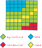
A spatial data model that defines space as an array of equally sized cells arranged in rows and columns, and composed of single or multiple bands. Each cell contains an attribute value and location coordinates. Unlike a vector structure, which stores coordinates explicitly, raster coordinates are contained in the ordering of the matrix. Groups of cells that share the same value represent the same type of geographic feature. 

Definitions from the GIS Dictionary


For more tips and tricks, see the chapter on creating a Minimum Essential Dataset for your response area, see the Using GIS for Wildland Search and Rescue eBook.

GIS Training  

Esri Training (training.esri.com)
University Training

Help & Resources

Here are some resources for getting help with MapSAR, IGT4SAR, and ArcMap.
Discussion Topics
Here are some of the topics that came up during the class that we would like to open up to the community.

  • Integration of SAR Theory into GIS 
  • Assignment versus Segments
  • Making maps for mobile via pdf
  • Real-time GIS (Integration APRS, ArcGIS Online with Collector)
  • State-wide SAR Minimum Essential Dataset
  • Pre-planning Search Segments (see blog post)
  • Fast Basemaps (see blog post)
  • Beyond MapSAR (Analysis tools using DEM such as slope, viewshed, elevation profile, etc)
Thank you

Stay tuned...
  • The training materials will be posted as soon as we have incorporated feedback
  • We will use this as a template to help other instructors teach this in their own community
  • Teaming up with a local University has proven to be a great way to introduce GIS experts and SAR Teams!
Dont' forget to add your team to our map (lat/long)!

View Larger Map

Tuesday, October 22, 2013

Search and Rescue GIS Resources for Canada


After our recent MapSAR Training event at SARScene Canada 2013, Rick Laing of Ridge Meadows SAR, Elaine Girrior of Yellowknife SAR, and Peter Devanney of SAR Global 1 agreed to put together a shortlist of resources to start discussion and establish SARGIS collaboration across Canada. Here is what we have put together (this information may be useful even if your response area is outside of Canada).


Basemaps

With regards to basemaps there are many resources available to you already while connected to the internet. For instance, below is a map of all of the Community Maps Program participants who adding even more detail to the World Topographic basemaps. Also within ArcGIS Online and ArcGIS Desktop you have access to the basemap produced by the Open Street Map program. 


View Larger Map

To open these in ArcMap simply use the add basemaps function...

Here is a snapshot of some highly detailed data for Coquitlam 


Base Data

There is a whole section about how to organize your Minimum Essential Data in the Using GIS for Wildland Search and Rescue textbook (free download) and also in an earlier blog post "Pre-planning is half the battle". Base data can be tricky for new GIS users because these datasets tend be rather scattered across the internet and are hard to track down if you do not already work with a GIS Specialist. But we thought we would point out some Canada-specific data sources for all of you here.  

In many cases this will require you to download the data in various formats, unzip the data, add it to your map, and style it appropriately. 

Creating a layer package clipped for your specific area is a great way to keep these data portable and organized. When you unpack them they keep your geography and symbology and can be stored locally, on a portable drive, and ArcGIS Online.


ArcGIS Desktop for Nonprofit Organization Program by Esri Canada. Go to the website and Request Application for Membership

  • $100 for ArcGIS Desktop (administrative fee)
  • Designed for small ground SAR organizations in Canada 
  • Organization can not be a Nationwide and/or Government owned agency
  • Community Based Non Profit Volunteer Organization (with or without a CRA#)
  • Must be associated with SARVAC, CASARA, or Northwest Territories
  • CRA Charity registration number - not needed, simply note your relationship with SARVAC


Download MapSAR template for ArcGIS Desktop from www.mapsar.net

MapSAR is a free tool that runs with ArcGIS 10, 10.1, and 10.2 to store geospatial information, enabling SAR maps to be generated, stored, and printed quickly so that search teams can get out the door faster to look for the missing person.


Join our Discussion Group!

A group for National Park Rangers, Sheriffs, Mountain Rescue Associations and other emergency service people to discuss and help others use and implement GIS (Geographic Information Systems) technology in SAR (Search and Rescue), emergency and day to day operations. Central to our group’s goals is to make GIS techniques and technologies more accessible to non-specialists. Towards this end, we have continued to explore techniques and technologies that can create a more streamlined workflow and effective situational awareness when using GIS. 

What's next?

From here we hope the real discussions can begin. 

  • Should there be a Canada SARGIS User Group? 
  • Where will the next MapSAR Training be? 
  • How can base data and even pre-planned operational data be stored and shared for teams to utilize (see example)?
  • How do I meet local GIS Specialists and work with agencies already using GIS in my area? 

In the meantime, please do visit the NAPSG MapSAR and IGT4SAR for online training videos and stay informed via the SARGIS Discussion Group. Don just uploaded a video that highlights the importance of minimum essential datasets and breaks down some GIS basics here in this video: http://www.youtube.com/watch?v=qdOM9RsQ1ZI

Let's continue the discussion and collaborate around this topic. 

Thursday, December 6, 2012

"Clip Before You Go"


Today I spoke with Brian Quinn, a GIS Analyst for the County of Marin, California. We were discussing how he can support Marin County SAR as they begin implementing MapSAR and building out Minimum Essential Datasets. On the one hand most vector data can be collected ahead of time and stored as geodatabase and/or layer packages. But sometimes you need to quickly grab new data on the fly. Together, we thought of a really quick way the Marin SAR Team could use Free and Public ArcGIS image services to clip raster data (basemaps, elevation models, imagery) before leaving the office.


Here is what we tested in ArcGIS Desktop.

Image

  • Next Zoom into an Area of Interest and open the Image Analysis Window


ImageAnalysisWindow

  • Then use the Clip and Export buttons to grab the data you need


ClipAndSave

  • Finally, use your Using GIS for WiSAR textbook to figure out the best practice for adding this to your Minimum Essential Dataset (MED) within the MapSAR folder structure


SaveIt

These clipped rasters will now be available when you disconnect and can be added to your MapSAR document and printed on your maps. There will be size limitations but for most incident specific extents this should work. In the long term, you will need a more holistic approach to Data Management. See the Using GIS for WiSAR textbook.

For more information, see the Help on the Image Analysis Window. For another example of imagery deployed via free web services see the California Department of Fish and Game Map Services website.

This is just one of many ways you can collaborate with your local GIS Specialist. Most GIS Specialist are pretty friendly and eager to help because they likely found their profession in GIS by looking for meaningful work and making a difference. If you do SAR work, you likely have something in common. So - give them a call, buy them a beer, invite them to a SAR meeting, and send them to our SARGIS Discussion Group!