Here is a list we discussed:
- Roads
- Trails
- Trailheads
- Streams
- Powerlines

However, over the past year our Using GIS in WiSAR group have been tinkering with the use of Watershed Boundaries for the use of planning areas or even starting points for segment delineation.
*UPDATE* March 3rd 2017
Why watersheds? "It is evident that the topography affects how people move through their environment, so instead of looking at how far they travel in a straight line from where they were last seen in order to predict where to look for them, perhaps it would be better to analyze the topographic features around them. One way in which to do this is by analyzing their movement between watersheds." - Read more in Jared Doke's MS Thesis.
This has been further supported in research by Elena Salva in a research article titled: Evaluating Lost Person Behavior Models.
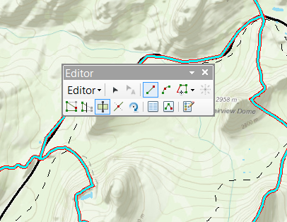
Now that the latest National Hydrological Dataset has been released, it would be a good idea to download the dataset and add it to your MED.

Then you can use some of the editing tools, such as cut polygons to begin breaking down the watershed boundaries into searchable segments by other features such as roads and trails.
This is a big breakthrough for Using GIS in WiSAR and researchers Jared Doke, Robert Koester, Don Ferguson, and Charles Twardy are testing these watershed boundaries against/with Lost Person Behavior models for determining Probability of Area. In addition Lori Peltz-Lewis will be working with GISCorps to make sure SAR Teams in California have this and other datasets for their MED.
I hope this post sparks discussion on pre-planning and discuss what others are doing or will do to prepare for their next search.
For those of you "North of the Border"....Here is a watershed data source that was forwarded to me today for Canada. I have not taken a look yet, but feel free to check out the
link.
http://geobase.ca/geobase/en/data/nhn/description.html
NHN dataset (Nation Hydro Network) that NRCAN provides. It has 1:50k data (interpolated from coarser data where finer data is not available) standardized across Canada. In some regions, the provinces have partnered up to provide better quality data and rely less on the
general computer model to compute the data.
*UPDATE* March 3rd 2017
The USA Watersheds are also available in ArcGIS Online for use in web maps, apps, and ArcGIS Pro through the Living Atlas of the World program. You can test this in the web mapping app embedded below.
The new hydrological dataset is a great addition. As I mentioned on the SAR & GIS site, it's much more accurate than previous versions -- lines actually follow ridges. It'll be great to see what watershed analysis Jared, Bob, Don et al come up with.
ReplyDeleteTo an MED, I'd add:
Cell &/or radio coverage with dead zones clearly marked. Initially, these can be done using analysis tools of Arc but should be ground truthed with local knowledge.
Using old files or old SAR people, create a historic SAR and Hazard map -- places where SARs have occurred as well as places that might potentially be terrain traps. Especially useful in areas where not many SARs happen and can serve as reminders of things to possibly include in planning if there's a search nearby.