Thursday, January 24, 2013
UTM / USNG Locator Map
So what if you just want to know what UTM / US National Grid Zone you are currently in or will be deploying to? Here is a simple and easy to use tool for you. Click on the image or here.

Monday, January 7, 2013
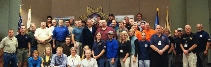
GISCorps volunteers assist in a Search & Rescue pilot project in California
GISCorps volunteers assist in a Search & Rescue pilot project in California.
Check out the link. This is excellent news from the GISCorps!
What is happening?
In late 2012, GISCorps received a request for volunteers from a consortium of GIS and Search and Rescue (SAR) professionals from Sierra Madre Search and Rescue Team, Esri, Sequoia and Kings Canyon National Park, Yosemite National Park, Grand Canyon National Park, and Mountaineer Rescue Group who have developed a Search and Rescue application called MapSAR. The consortium requested assistance to fill three GIS Specialist positions to support a pilot project in California using MapSAR. Those three positions were: GIS Trainers, GIS Practitioners and GIS Developers. The detailed job description for each position and other additional information is included in this document.
Who is GISCorps? From their website:
GISCorps started life in October 2003 in Atlanta, Georgia, when the URISA Board unanimously approved it as an initiative of URISA. This happened after an intensive summer of brainstorming, conceptualizing and a lot of hard work required to translate an idea into a well designed proposal. GISCorps is now a URISA program and operates entirely on a volunteer basis. The core committee members, most of whom are themselves GISCorps volunteers, run the program with administrative help from the staff at URISA. They reside in different states accross the United States and Canada and use a wiki site to work collaboratively, mostly at nights and on weekends. The links that follow describe in detail the mission and the operations of the GISCorps.
GISCorps volunteers' services will help to improve the quality of life by:
GISCorps has accepted the challenge and the California Emergency Management Agency SAR Operations and the National Park Service are anticipating the integration of GIS Specialists into their ranks for supporting Search Operations with GIS. This is a great opportunity to bring in GIS professionals and their expertise to support an inherently spatial problem: searching for missing persons. Once we have learned from this experience it can be taken to a national / international level.

Check out the link. This is excellent news from the GISCorps!
What is happening?
In late 2012, GISCorps received a request for volunteers from a consortium of GIS and Search and Rescue (SAR) professionals from Sierra Madre Search and Rescue Team, Esri, Sequoia and Kings Canyon National Park, Yosemite National Park, Grand Canyon National Park, and Mountaineer Rescue Group who have developed a Search and Rescue application called MapSAR. The consortium requested assistance to fill three GIS Specialist positions to support a pilot project in California using MapSAR. Those three positions were: GIS Trainers, GIS Practitioners and GIS Developers. The detailed job description for each position and other additional information is included in this document.
Who is GISCorps? From their website:
GISCorps started life in October 2003 in Atlanta, Georgia, when the URISA Board unanimously approved it as an initiative of URISA. This happened after an intensive summer of brainstorming, conceptualizing and a lot of hard work required to translate an idea into a well designed proposal. GISCorps is now a URISA program and operates entirely on a volunteer basis. The core committee members, most of whom are themselves GISCorps volunteers, run the program with administrative help from the staff at URISA. They reside in different states accross the United States and Canada and use a wiki site to work collaboratively, mostly at nights and on weekends. The links that follow describe in detail the mission and the operations of the GISCorps.
GISCorps volunteers' services will help to improve the quality of life by:
- Supporting humanitarian relief.
- Enhancing environmental analysis.
- Encouraging/fostering economic development.
- Supporting community planning and development.
- Strengthening local capacity by adopting and using information technology.
- Supporting health and education related activities.
GISCorps has accepted the challenge and the California Emergency Management Agency SAR Operations and the National Park Service are anticipating the integration of GIS Specialists into their ranks for supporting Search Operations with GIS. This is a great opportunity to bring in GIS professionals and their expertise to support an inherently spatial problem: searching for missing persons. Once we have learned from this experience it can be taken to a national / international level.
Subscribe to:
Posts (Atom)