Event
On February 8th, 2017 the NAPSG Foundation provided a virtual workshop for the Montana Association of Geographic Information Professionals (MAGIP) and local search and rescue team members. While MAGIP attendees attended on-site (Bozeman, Montana), they also extended the invitation to the Public Safety GIS and SAR Community to attend via WebEx. You can watch this presentation here via WebEx video.The objective of this presentation was to foster exchange between the Geospatial Professional and Search and Rescue Communities by providing an overview of capabilities with geospatial decision support tools and building a common language.
We feel we have achieved this objective. As a result of this event, the local SAR Teams and GIS Professionals plan to meet more regularly, share data, and train on using geospatial decision support tools for search operations. In addition, the audience agreed they would like to participate in future SARGIS workshops, including the 9th Annual Search and Rescue GIS Workshop (SARGIS9 - November 2017, Rocky Mountain Region).
Resources
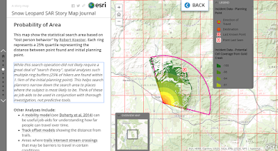
We used the SARGIS8 Training Story Map to guide the presentation and discussion. This website includes downloadable tutorials and interactive examples to show your local SAR Team. You can access this free training resource here: http://bit.ly/BasicSARGISIn addition, the case-study we used to kick-off the event was based on a group of photographers who were stranded in the mountains north of Bozeman, Montana. Geospatial intelligence was critical in this mission and the Story Map allows us to review the mission and learn from it. You can access this interactive Story Map here: http://arcg.is/2lmtuaC
For information about GIS for Search and Rescue and to begin developing geospatial decision support tools for your SAR Team, see the Wilderness Search and Rescue Capability and Readiness Assessment Tool (CARAT).
Special thanks to Curtis DeVault of MAGIP, Angela Pervél of NAPSG Foundation, and Don Ferguson SARWG Co-chair for helping to make this event possible despite my crazy schedule and presenting remotely from New Zealand.

