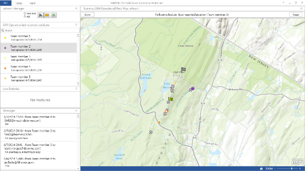
Click on the link: Map Tour
In the year 2014, great advances were made in the use of geographic information systems for wildland search rescue.
- MapSAR and IGT4SAR were used to support a number of missing person search operations
- Workshops were held across North America
- There were several peer-review publications on the use of GIS in WiSAR
- The US National Park Service has recognized the GIS Specialist role as a necessary incident command structure position during search operations
What can we do in 2015 as a volunteer community to increase the adoption of GIS as a critical SAR function in North America and abroad?
- Develop simple to use geo-enabled applications for mission critical tasks?
- More SARGIS workshops?
- Form a recognized non-profit organization with operational capacity to help when needed?
- Present to emergency management and law enforcement agencies?
- Lobby to federal governments for more support?
- Strengthen the alliance with GIS volunteers like GISCorps, MapAction, MAPS?
- Create a research and development center for WiSAR GIS?
These are all ideas that have been discussed and are always on my mind. Now that the SARGIS Discussion Group has reached +600 members across the world I truly believe we have reached the critical mass to make global change.
I think we can all agree, that someday, when a person goes missing, the use of GIS for planning, operations, logistics, command, and public information will be the "standard of care". Imagine that your loved one (a relative, a spouse, your child) was missing - how would you want the search management team to use geographic information?
Let's make 2015 a spectacular year and have a great time doing it - so that others may live...
Please add comments below if you think we missed an event, have a case-study you think should be highlighted, or have ideas on how we can make a bigger impact.
Please add comments below if you think we missed an event, have a case-study you think should be highlighted, or have ideas on how we can make a bigger impact.

.JPG)
.JPG)
.JPG)


